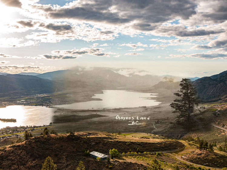
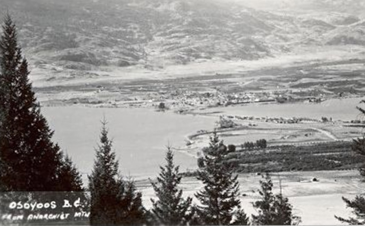
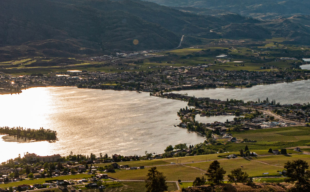
Located in the far south of the Okanagan, Lake Osoyoos is the warmest lake in Canada, surrounded by a vibrant desert ecosystem and lush green orchards and vineyards. The area has been home to the Syilx Okanagan First Nations for millenia and was originally called "Sẁiẁs", which refers to the narrowing of the waters of the lake. Europeans first passed through the South Okanagan in 1811 as part of the fur trade, and Osoyoos's first permanent white settlers were cattle ranchers and farmers in the late nineteenth century. The town also served as an important spot for government, as it was home to a customs house run by Judge Haynes, who was both deputy customs collector and a justice of the peace during his career. The first orchards in Osoyoos were planted in 1857, and since then, orcharding has become a major part of the culture and economy of the town. Today, Osoyoos is home to numerous orchards, vineyards, and wineries, and its thriving community enjoys some of the warmest weather in the country.


This project was made possible through a partnership with Visit South Okanagan, with support from Destination Osoyoos and the Osoyoos & District Museum and Archives.
We respectfully acknowledge that Osoyoos is within the ancestral, traditional, and unceded territory of the Syilx People of the Okanagan Nation.


Explore
Osoyoos
Stories
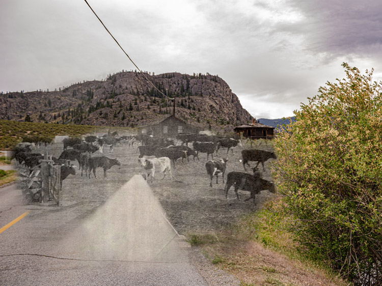
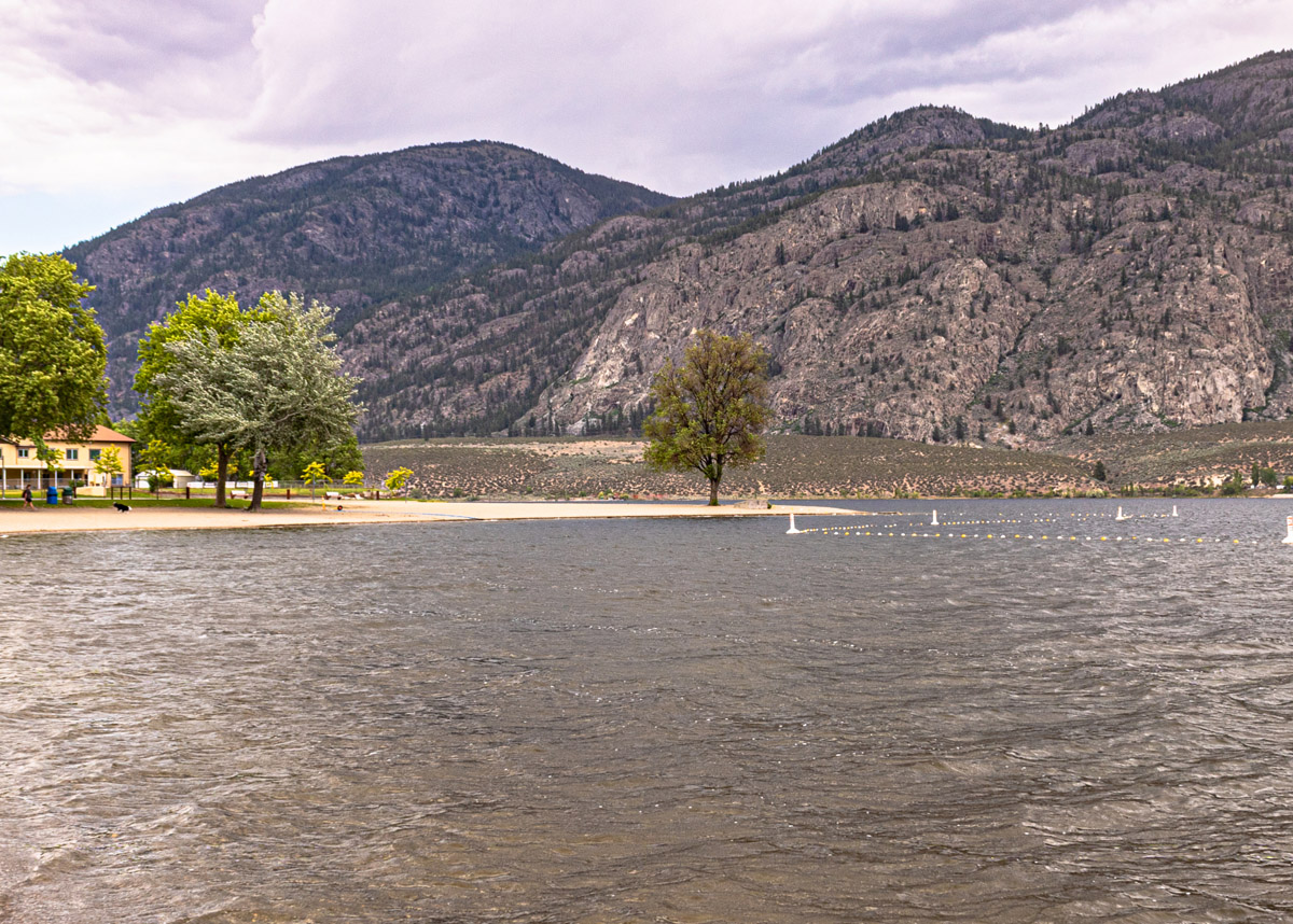
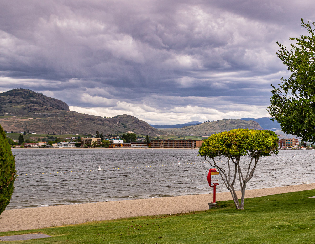
"sw̓iw̓s" - The Narrowing of the Waters
Osoyoos and District Museum and Archives 2008.001.073
Story Location
For thousands of years before the arrival of the first Europeans in the Okanagan in 1811, the sukʷnaʔqinx Okanagan First Nations people lived and thrived on this land, and today, their communities remain vibrant and strong. The Okanagan syilx Nation comprises seven communities in the Southern Interior of British Columbia and one in Washington State. These communities share the same land, nqilxʷcn/nsyilxcən language, culture, and customs and are a distinct and sovereign Nation. Their unceded traditional territory stretches from Mica Creek in the British Columbian interior down to Wilbur in Washington State and from Guichon Creek to Kootenay Lake in the east. The name "Osoyoos" comes from the nqilxʷcn word "súyus” meaning “narrow waterway where the land almost meets” which refers to the narrow spot in the lake that may have been used for crossing and is located where the Osoyoos Main Street bridge now sits. The other crossing ground is sw̓iw̓s, which refers to a spot in the middle of a lake where the land narrows or grows shallow. sw̓iw̓s, formerly known by the European name "Haynes Point", was originally a natural crossing spot on Osoyoos Lake, used by the sukʷnaʔqinx Okanagan People during their travels. Recent work in sw̓iw̓s park uncovered an important archaeological and culture site located on the point, and the park is now operated by the Osoyoos Indian Band.
* * *
The first Europeans to travel to the Okanagan were fur traders with the Pacific Fur Company, travelling through the region on what would become known as the Fur Brigade Trail in 1811. From then on, settlement of the area by Europeans increased at a gradual yet inexorable rate. Land treaties were never made, and while fairly large reserve lands were promised to the Okanagan First Nations people by Governor James Douglas in the middle of the 19th century, these promises were later broken. When Douglas left office in 1864, one of the new government's first acts was to reduce Okanagan reserve sizes. John Carmichael Haynes, one of the first white settlers in Osoyoos, was originally stationed there as deputy customs collector in 1862. In 1865, he was granted government permission to reduce the reserve sizes of two reserves in the Okanagan. In 1879, the crown granted Haynes 4,245 acres of land in the area near Osoyoos, which the government had previously promised to set aside as reserve land, a decision which was later attributed to "a settler's bad faith and a clerk's error."1 The historian Duncan Duane Thomson wrote in a 1985 UBC dissertation: “The evidence seems to lead to only one conclusion—the Inkamip Indians were cheated out of land which had been assigned to them by the Indian Reserve Commissioners and Commissioner Sproat... While one man dominated the main trench of the Okanagan, nearby, the Indians with 34 adult males were restricted to a dry, rocky and sandy area with little access to water.”2 Additionally, the government passed legislation in 1871 which allowed white settlers to preempt a total of 320 acres of land as opposed to the previous allowance of 160 acres. This allowed settlers to claim more and more land, controlling not only the best agricultural lands, but also much of the region's water. The Okanagan people were cut off from their land, water, and, largely, their traditional ways of life. Yet despite the many impacts of European settlement, the Osoyoos Indian Band is today a thriving and successful community that has created many profitable business and cultural ventures such as the Nk'Mip Desert Cultural Center, the Nk'Mip Canyon Desert Golf Course, Spirit Ridge Resort, and Nk'Mip Cellars, which is the first Indigenous owned and operated winery in Canada. Since 2015, the Band has generated nearly $120.1 million in revenues from these ventures, and unemployment on the reserve is 3%, well below the national average.3 You can learn more about the history and culture of the sukʷnaʔqinx at the Nk'Mip Desert Cultural Centre, located on the eastern side of Osoyoos Lake.
2. Thomson, Duane Duncan. A History of the Okanagan: Indians and Whites in the Settlement Era, 1860 - 1920. The University of British Columbia, September 1985, pp. 147. URL: https://open.library.ubc.ca/cIRcle/collections/ubctheses/831/items/1.0107160
3. "Businesses." Osoyoos Indian Band. URL: http://oib.ca/businesses/
The Earliest Fruit in Canada
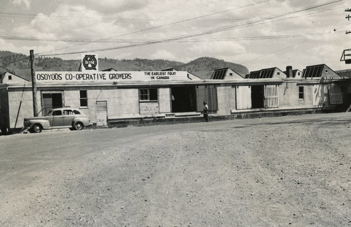
Enderby and District Museum and Archives EDM-3726
Story Location
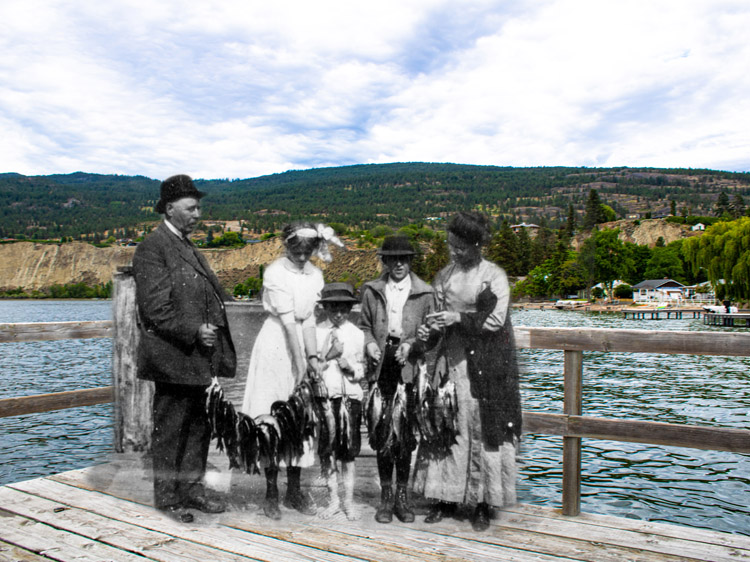
Ever since the first orchards in the Okanagan were planted beside Osoyoos Lake by Hiram F Smith in 1857, Osoyoos has been the home of orchards, fruit trees, and an economy which revolves around agriculture. As George Fraser wrote in The Story of Osoyoos in 1952: "Osoyoos residents do not boast of a climate unexcelled elsewhere but they will stoutly maintain that the Southern Okanagan shares with the Southern Similkameen the most pleasing year round climate in Canada, a climate that enables us to proudly boast of our district producing the earliest fruit in Canada."1 It's hardly surprising then that "the earliest fruit in Canada" was the town's slogan for decades.
* * *
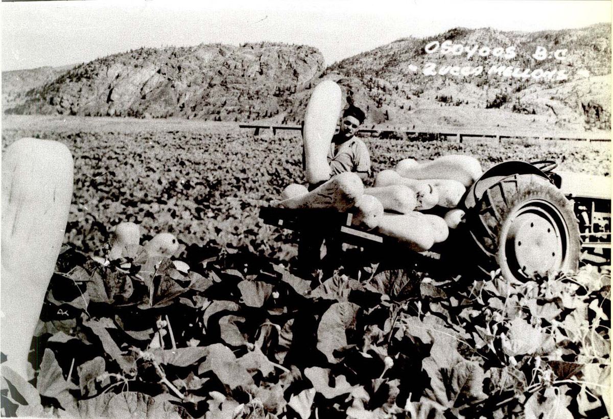
Smith's orchards, while they contained over 1,000 trees and vines, were located across the American border to the south. The first commercial orchards on the Canadian side of the border were planted much later, by Leslie Hill in 1907. He bought 1,100 acres of land on Osoyoos Lake and planted 30 acres of fruit trees, including cherries, pears, peaches, apricots, plums and apples. From then on, fruit growing made up a major part of the community's economy. In addition, vegetables like tomatoes, cucumbers, cantaloupes and zucca melons were grown between the rows of fruit trees to provide farmers with income while their young trees matured.2 Agricultural production only increased in the following decades and, given this agricultural history, it is perhaps not surprising that in 1949, Osoyoos developed an annual summer celebration on July 1st known as the Cherry Carnival. The Carnival honoured the fruit trees which had given Osoyoos much of its prosperity. Today, the festival is still going strong, though its name has since changed to the Cherry Fiesta. The first Cherry Carnival was based around aquatic sports to take advantage of the town's location on the banks of the Osoyoos Lake. The goal was to draw large crowds and raise funds to go towards park development. According to historian George Fraser writing in his 1952 book The Story of Osoyoos, this goal was reached: the first festival had a profit of $1,176.08, which would amount to over $13,500 in today's money.3
2. Fraser, Dorothy. "A Short History and Description of Osoyoos." Osoyoos Museum, 1967, p. 6. URL: http://www.osoyoosmuseum.ca/index.php/about-us/history-of-osoyoos/a-history-and-description-of-osoyoos.html
3. Fraser, George J. 54.
4. "The Way We Were: First Cherry Carnival in 1949." Osoyoos Times, 2018. URL: https://www.timeschronicle.ca/the-way-we-were-first-cherry-carnival-in-1949-was-aquatic-sports-event-but-parade-was-always-popular/
Watering the Desert
Story Location
The climate and ecosystems of the South Okanagan are unique to British Columbia. The desert grasslands are home to sagebrush, cacti, and the occasional ponderosa pine, and the area holds a rich depth of biodiversity. Around 190 species of birds breed in the South Okanagan, and the Okanagan Valley as a whole is home to more species of plants and animals than most other areas of the province—or the country for that matter.1 The climate which created this unique and beautiful region has also proved to be perfect for growing fruit, yet in the beginning of the agricultural industry in the Southern Okanagan, one main problem persisted: water. The dry climate and desert-like ecosystem made irrigation a major challenge for early farmers. D.V. Fisher of the Dominion Research Station in Summerland described the irrigation systems in place during the early years of farming in the South Okanagan as "totally inadequate."2
* * *
The creation of early irrigation systems generally fell to the developers of land. Across the South Okanagan, rich landowners would buy large plots of land, subdivide them, and sell them to farmers. It was in their interest to provide watering systems to their purchasers; a plot of land without irrigation could be sold for $10 to $40 an acre, while one with irrigation could instead be sold for $150 to $350 an acre—water was everything.3
With the promise of this price hike, however, less wealthy developers often created inadequate irrigation systems, with plans to later improve them with the profits from land sales. When these sales slowed down, as they did during a real estate depression in 1912, those farmers who had already purchased land were left with shoddy systems and an inability to properly water their orchards.
In Osoyoos, however, a developer-created irrigation system was put in place which was actually successful. A land syndicate headed by George Fraser in 1920 purchased land on the eastern shore of Osoyoos Lake from Leslie Hill, who had planted Osoyoos's first commercial orchards over a decade previously, and subdivided it, selling plots to new farmers.
That same decade, the BC government became involved in the problem of irrigation. After the First World War, Premier John Oliver began a land settlement and irrigation project which was intended to provide cheap, easily farmed land for returning soldiers. The South Okanagan Lands Project was centred on the creation of the town of Oliver, but Osoyoos eventually benefitted too—in 1927, water from the government's successful irrigation project in Oliver reached the west side of Osoyoos Lake.4
With access to an irrigation system now secured, the lands surrounding Osoyoos Lake gradually filled, and the population of the settlement increased. Many of the farmers who settled in the region were from diverse backgrounds. A large portion of the original orchards were planted by German immigrants. Later, Portuguese fruit growers arrived in the South Okanagan in 1955, originally as farm labourers. By the late 1980s, these immigrants owned half the orchard land in Oliver and Osoyoos. Likewise, by 1987, there were 200 families of Hungarian immigrants in the Oliver and Osoyoos area. This growing diversity created a vibrant and multicultural community.
With increased settlement and irrigation waters secured, the desert lands surrounding Osoyoos slowly grew covered in lush green farms. In 1944, in the midst of the Second World War, a spur line of the Kettle Valley Railway was finally built to Osoyoos, and transporting fruit grew easier and more profitable.
Vineyards first entered the scene in the 1970s, at a time when the global popularity of wine was taking off. Today, there are over 5,000 acres of vineyards in the region of Oliver and Osoyoos. Osoyoos also has the distinction of being home to the first Aboriginal owned and operated winery in North America: Nk'Mip Cellars.
Yet the agricultural prosperity of the region came at a cost. Farming encroached on the important desert grassland habitat. As early as 1998, the BC Ministry of Environment listed the South Okanagan grasslands as "one of the four most endangered ecosystems in our country."5 Agriculture and urban development has replaced most of the original grasslands.
In Osoyoos, a 1,600 acre desert conservation area was created in 2007 by the Osoyoos Indian Band, who founded the Nk'Mip Desert Cultural Centre to not only protect this important ecosystem but to provide cultural and ecological education to visitors and locals alike. The state-of-the-art interpretive centre located on the east side of Osoyoos Lake is constructed into the hillside and built to be as environmentally sensitive as possible. The centre works towards the stewardship of both the natural landscape of Osoyoos and the rich culture of the Okanagan First Nations people.
Visitor’s can also experience the beauty and diversity of this unique desert environment at the Osoyoos Desert Centre, a 67-acre nature interpretive facility located three kilometres north of Osoyoos. Guided and self-guided tours are available along the 1.5 kilometre elevated boardwalk, and the centre includes hands-on displays and a native plant garden. The Osoyoos Desert Centre is operated by the Osoyoos Desert Society, a non-profit charitable organization dedicated to conserving the South Okanagan’s rich biodiversity for future generations. The society was formed in 1991 by volunteers and has been working towards preserving the desert ecosystem ever since.
2. Webber, Jean. A Rich and Fruitful Land: The History of the Valleys of the Okanagan, Similkameen and Shuswap. Harbour Publishing, Madeira Park, 1999, pp. 169.
3. Webber, Jean. 172
4. Cox, Doug. Okanagan Roots… A Historic Look at the South Okanagan and Similkameen. Skookum Publications, 1987, pp 78.
5. "Habitat Atlas for Wildlife at Risk."
Then and Now Photos
The Cherry Carnival Parade
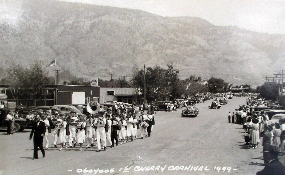
1949
Osoyoos's first annual Cherry Carnival, now known as the Cherry Fiesta, took place in 1949 on July 1st. This photo shows a parade down Main Street during the festivities.
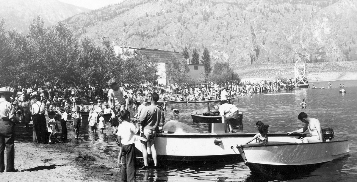
Cherry Carnival Water Events

Osoyoos and District Museum and Archives
1949
The first Cherry Carnival in Osoyoos took place on July 1st in 1949 and was heavily based around aquatic sports in order to take advantage of the warm Osoyoos Lake. This photo shows the large crowds gathered on the beach for the festivities, with many revelers either in boats or in the water.
Cherry Carnival Tricycle Parade
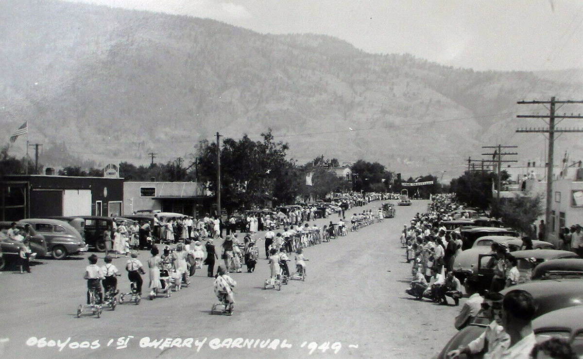
1949
This photograph from the 1949 Cherry Carnival shows one of the festival's most popular events: the parade. As evident in this photo, the parade included an array of tricycles, bicycles, and baby carriages. There were also clowns, floats to represent various businesses, and a "pet parade" to bring up the rear.
The Community Hall
Osoyoos and District Museum and Archives 2006.001.241
1940s
This photograph shows the Osoyoos Community Hall, which was located on the shores of Osoyoos Lake. It was built in the 1930s by the Community Club, which was founded in 1934 with the express purpose of getting a hall built. The Community Hall was demolished in 1995.
Osoyoos Beach and Community Hall
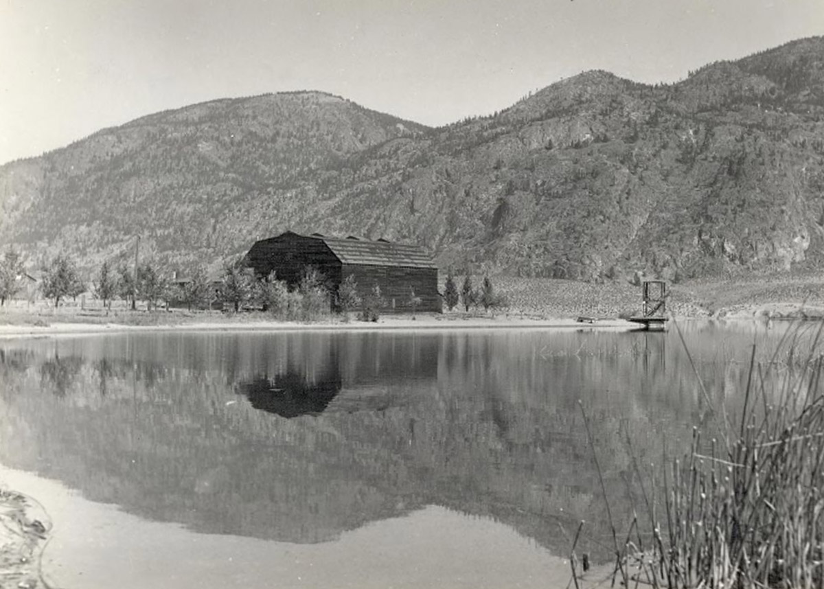
Osoyoos and District Museum and Archives 2011.001.030
1930s
Built in 1934, the Osoyoos Community Hall sat on the lakeshore until it was demolished in 1995. It served as a place for community meetings, dances and music nights, and sporting events.
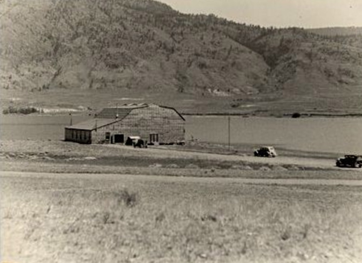
Haynes Family at Ranch
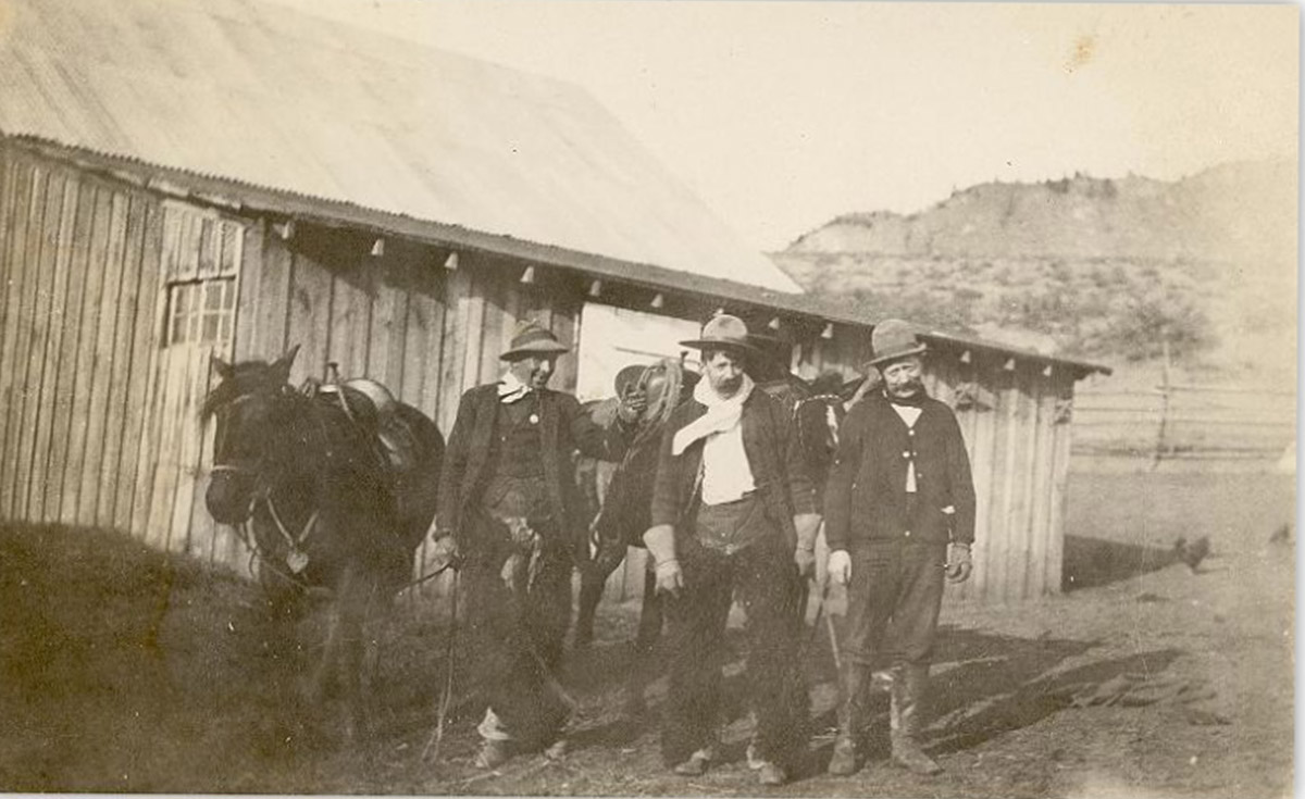
Osoyoos and District Museum and Archives 2011.008.013
1920s
This photograph shows the Haynes family at their ranch north of Osoyoos Lake. The group is standing with horses in front of one of their barns, built in 1916, which is still there today.
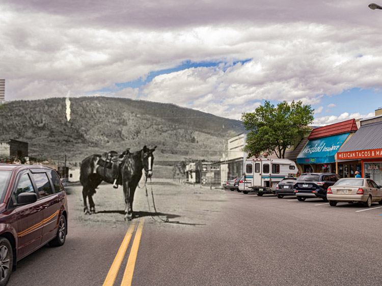
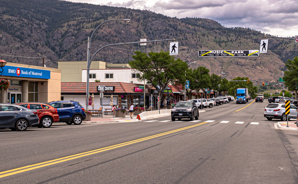
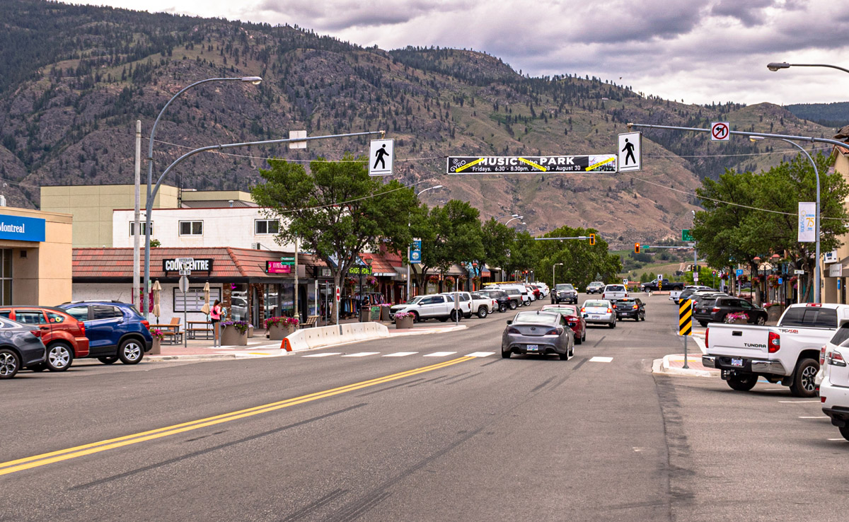
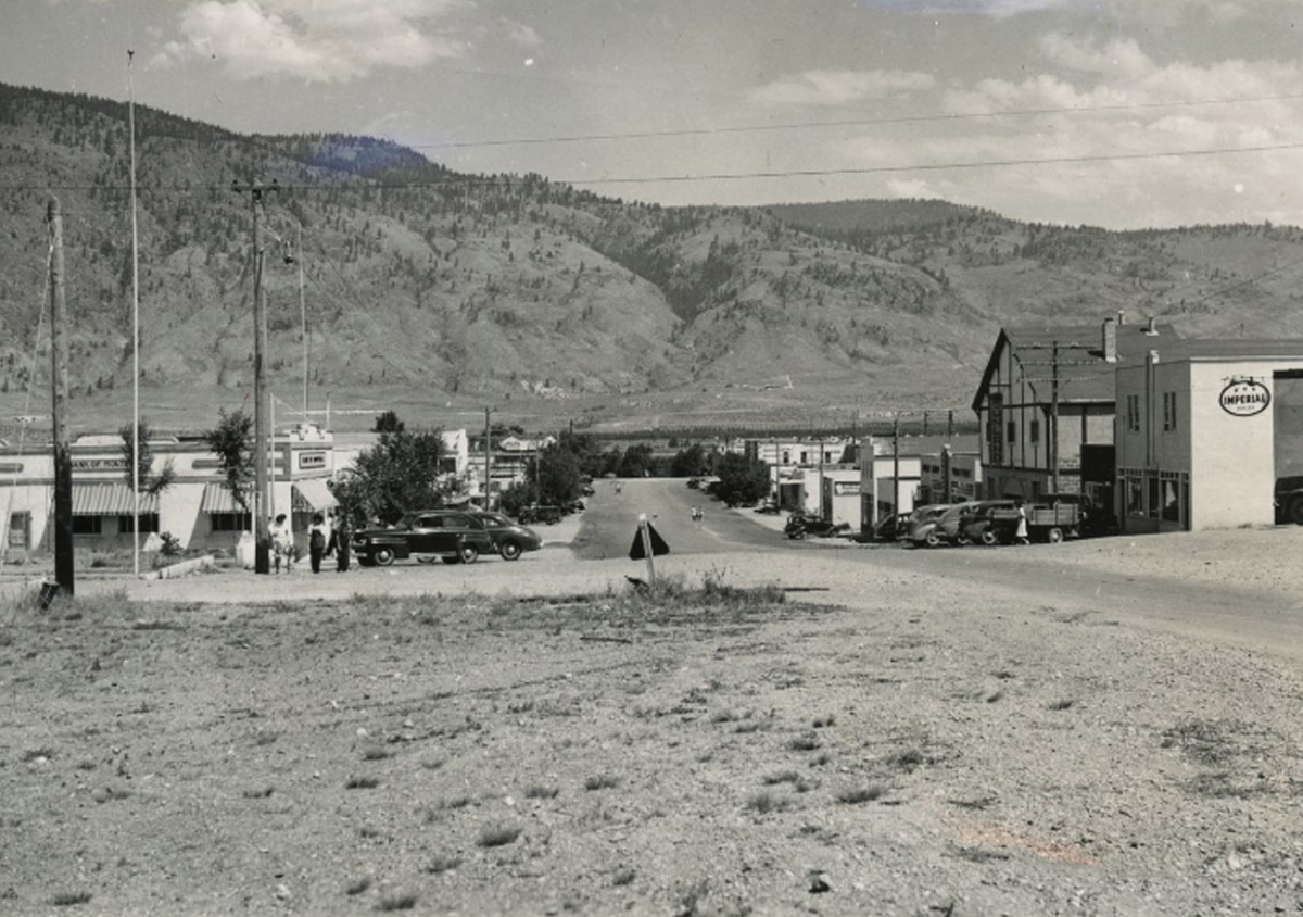
Main Street Looking West
Osoyoos and District Museum and Archives 2006.001.316
1940s
This photograph of Main Street looks west, away from Osoyoos Lake. The road is still unpaved, but cars are parked on the shoulders.
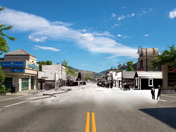
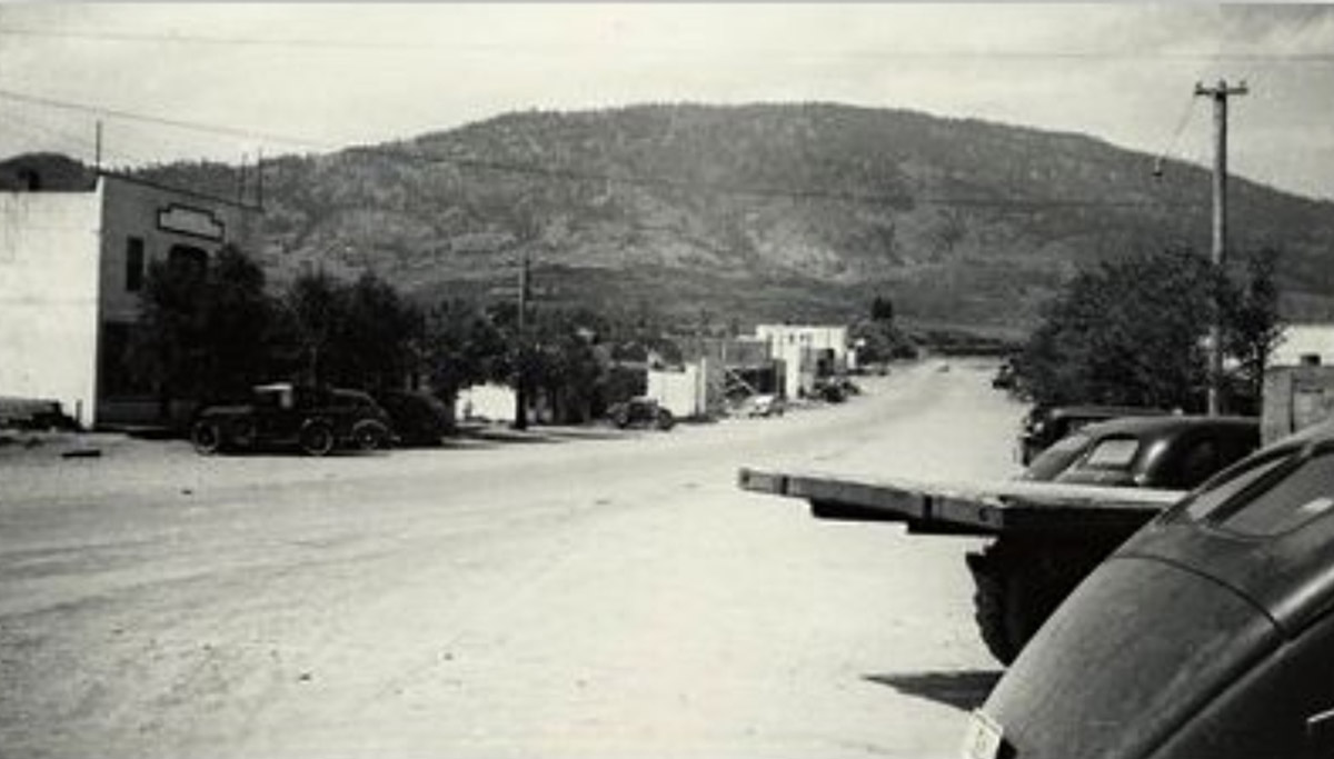
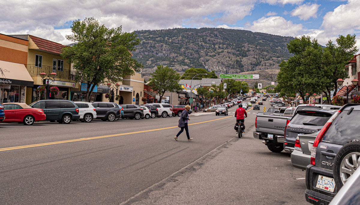
Main Street in the 1940s
Enderby and District Museum and Archives EDM-3726. B.C.'s Inland Empire photo no. 441
1940s
This view of Main Street is from the late 1940s, looking east towards the lake. The two-storey peaked building on the right was built in 1946 by J Jalovec and served as the home of his dry goods and tailoring business, Modern Tailors.
Old Osoyoos
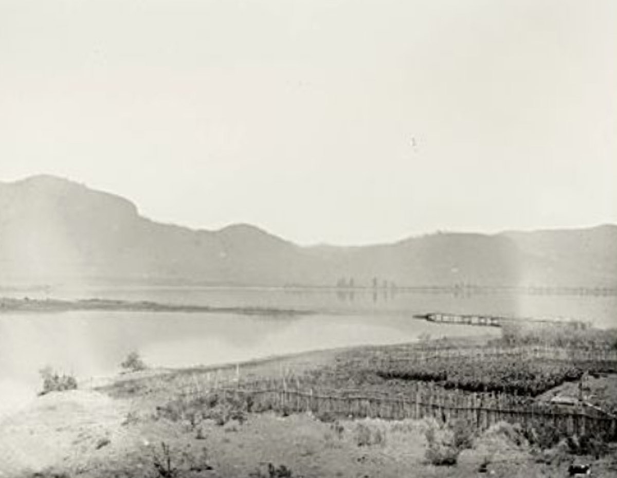
Osoyoos and District Museum and Archives local identifier: 2004.001.001
1877
This panorama, taken in 1877 while G.M. Dawson was first mapping the Okanagan, shows Osoyoos before the town was built, looking south towards the narrows. The wooden fence in the foreground belonged to Theodore Kruger's garden, and the hand pump to the right of the photo shows the first manipulation of water in the area.
The Old Town Site
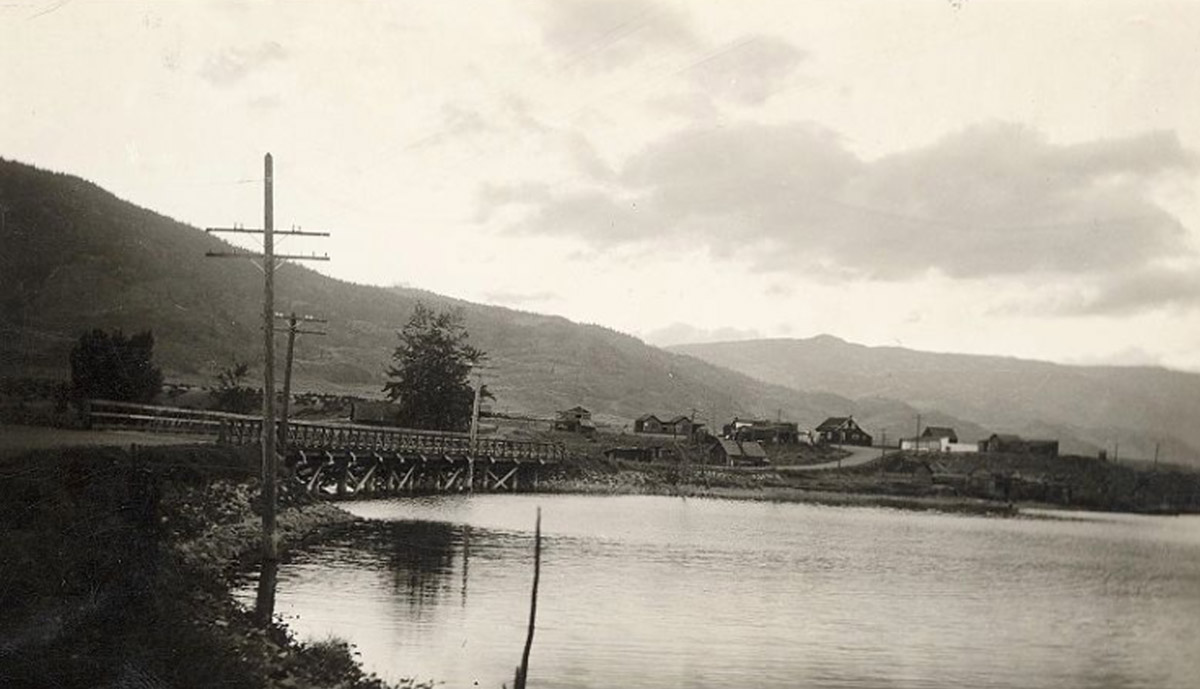
Osoyoos and District Museum and Archives 2011.011.001
This photograph looks west across the bridge towards the original townsite of Osoyoos. The town later shifted to the north.