Partner City
Medicine Hat
The Gas City
The city of Medicine Hat first began in 1883 as a tent city for workers of the Canadian Pacific Railway, who were constructing a bridge across the South Saskatchewan River. Gradually, with the coming of the railway and the arrival of the North West Mounted Police, the tent city gave way to a town, and when CPR workers searching for water struck natural gas instead, economic development took off in the area. The community quickly became one of the largest in the province and was incorporated as a city in 1906. Resources such as natural gas and clay fuelled the economy, and several large industries began to be established. Today, Medicine Hat is moving away from natural gas as prices drop, but manufacturing has become an important part of the city's economy.
We respectfully acknowledge that Medicine Hat is on the traditional territories of the Siksikaitsitapi (Blackfoot) and the people of the Treaty 7 region in Southern Alberta, which includes the Siksika, the Piikani, the Kainai, the Amskapi Piikani nations.


Explore
Medicine Hat
Then and Now Photos
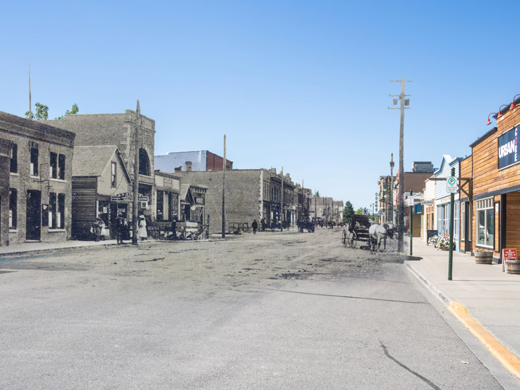
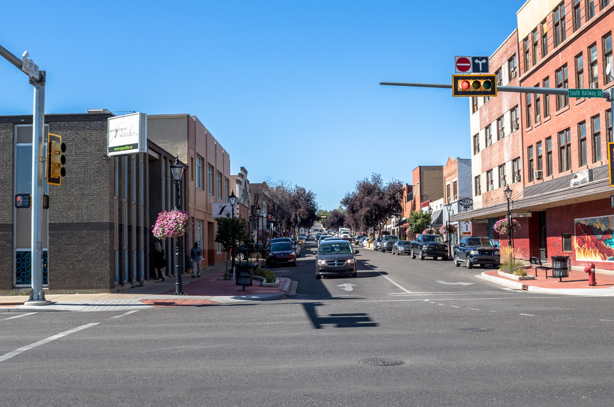
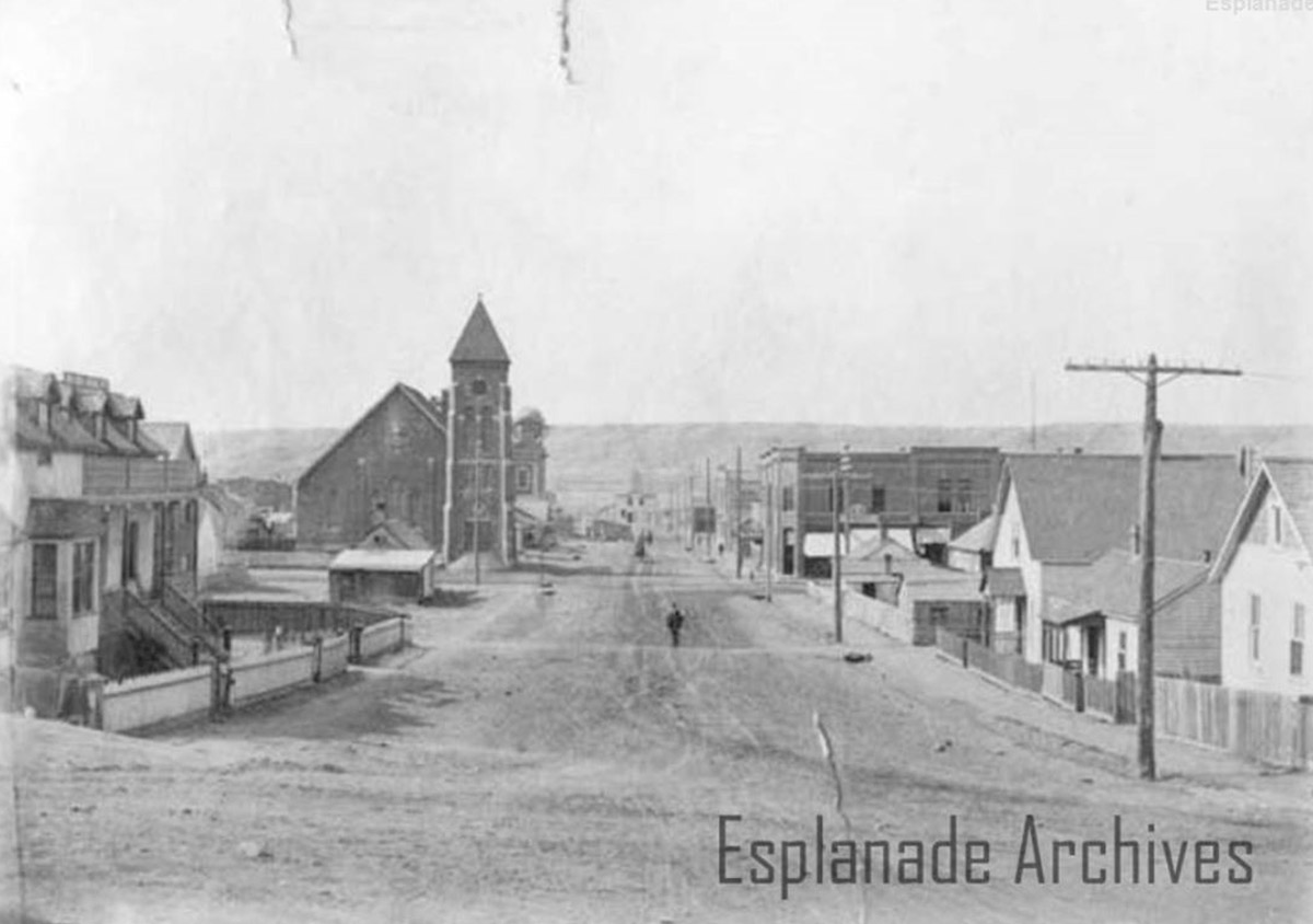
Second Street and Post Office
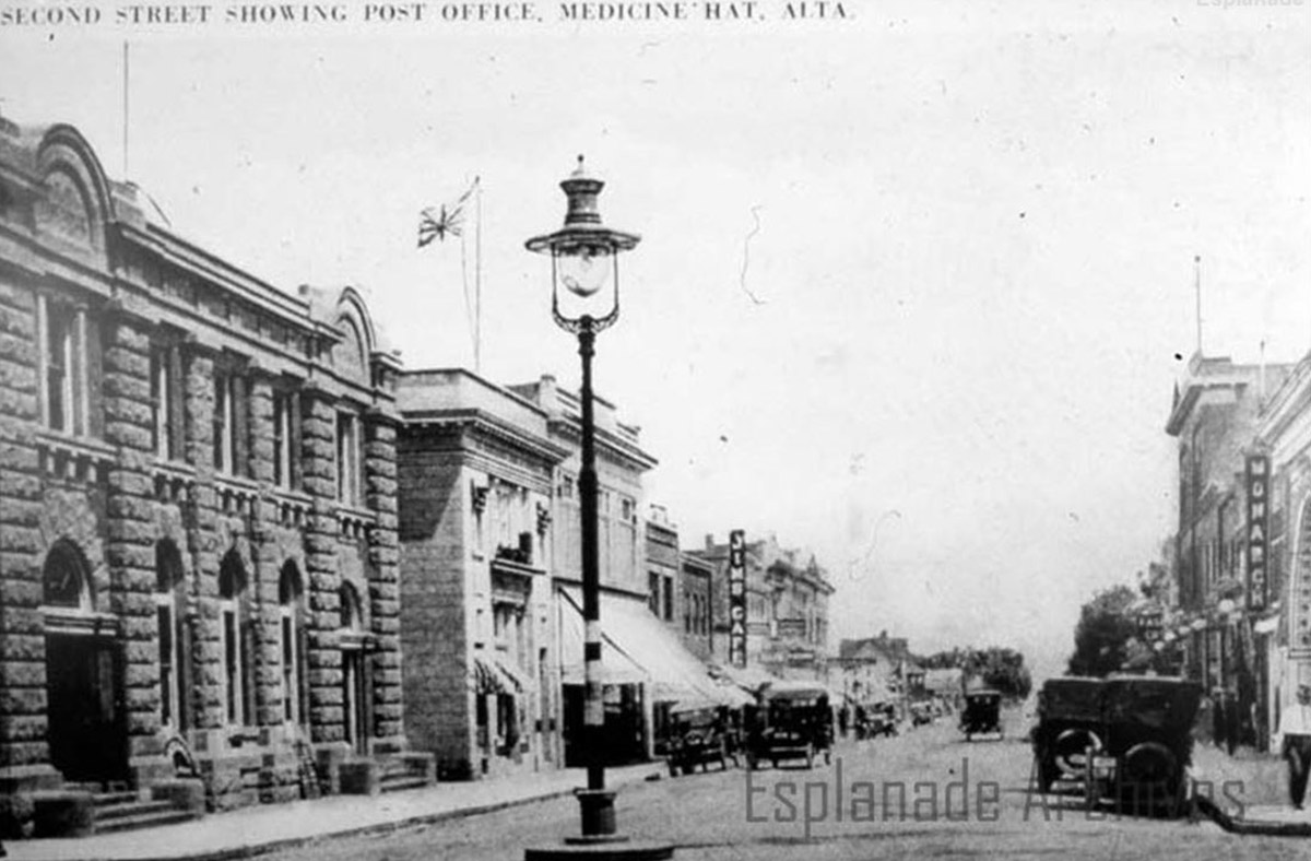
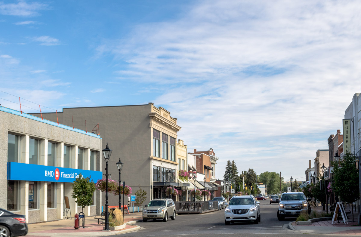
This photograph shows Second Street Southeast in Medicine Hat, including the post office and the historic Monarch Theatre. The large gas lamp in the centre of the street would have been supplied with natural gas from Medicine Hat's own gas fields.
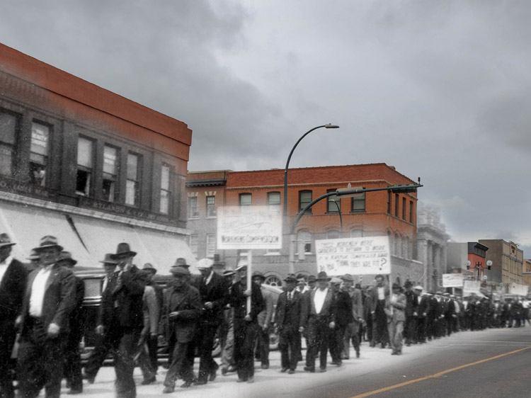
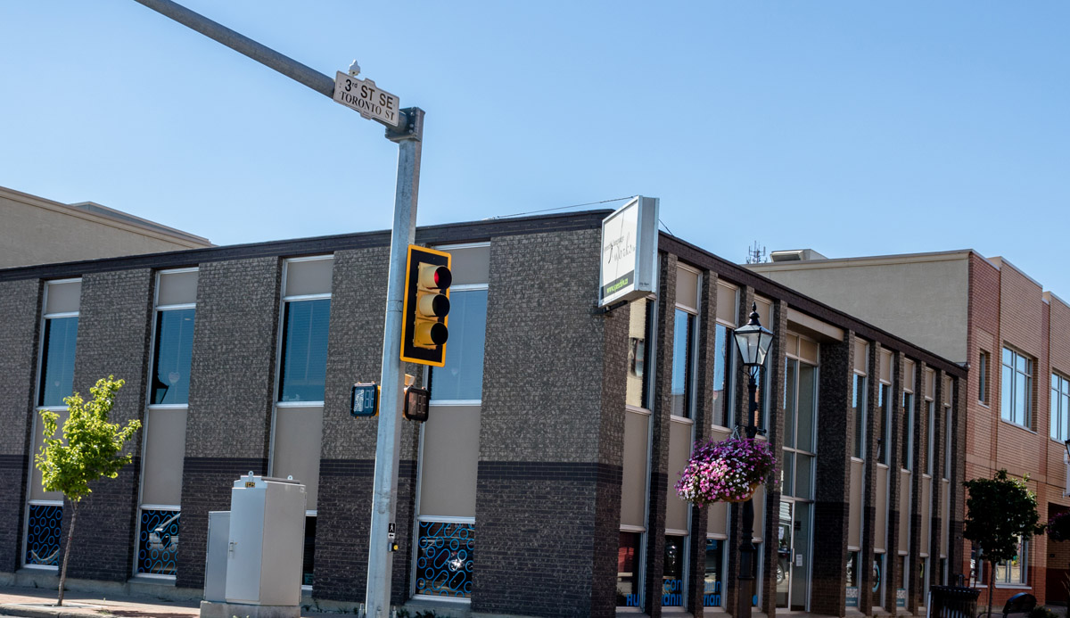
Orangeman Procession
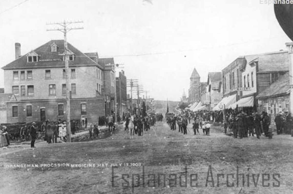
1903
This photo shows a procession of the local Medicine Hat Orangemen on Toronto Street, now known as Third Street. Members of the Redcliff Orange Lodge also came to the town to join in the parade. The Orange Order was a political and religious fraternal society originating in Ireland that grew popular across Canada throughout the nineteenth and twentieth centuries.
City Hall and Fire Station
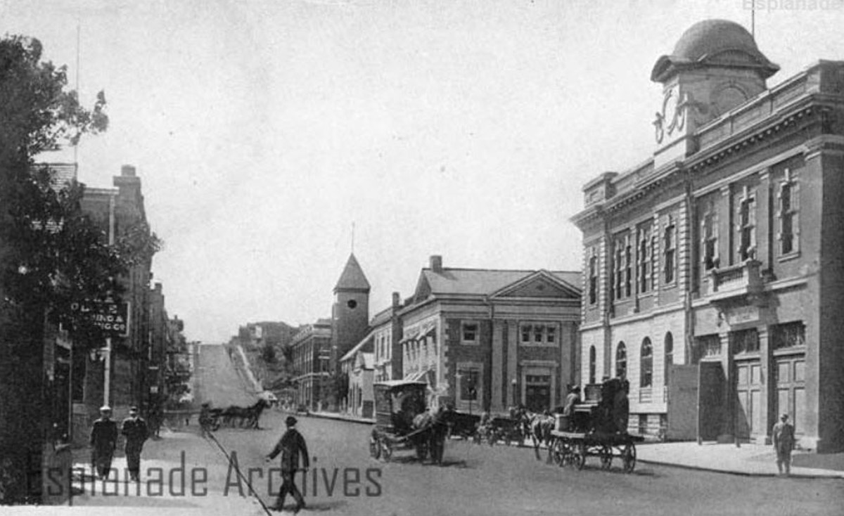
1912
This photography shows Sixth Avenue, with the original Medicine Hat City Hall and Fire Station on the right side of the street. The City Hall was demolished in 1983 due to deterioration of the building and its small size. A new city hall was constructed a block away from this site. Interestingly, this picture also shows a mixture of horse-drawn and motor traffic, including a cart, on the right, which is transporting an upright piano.
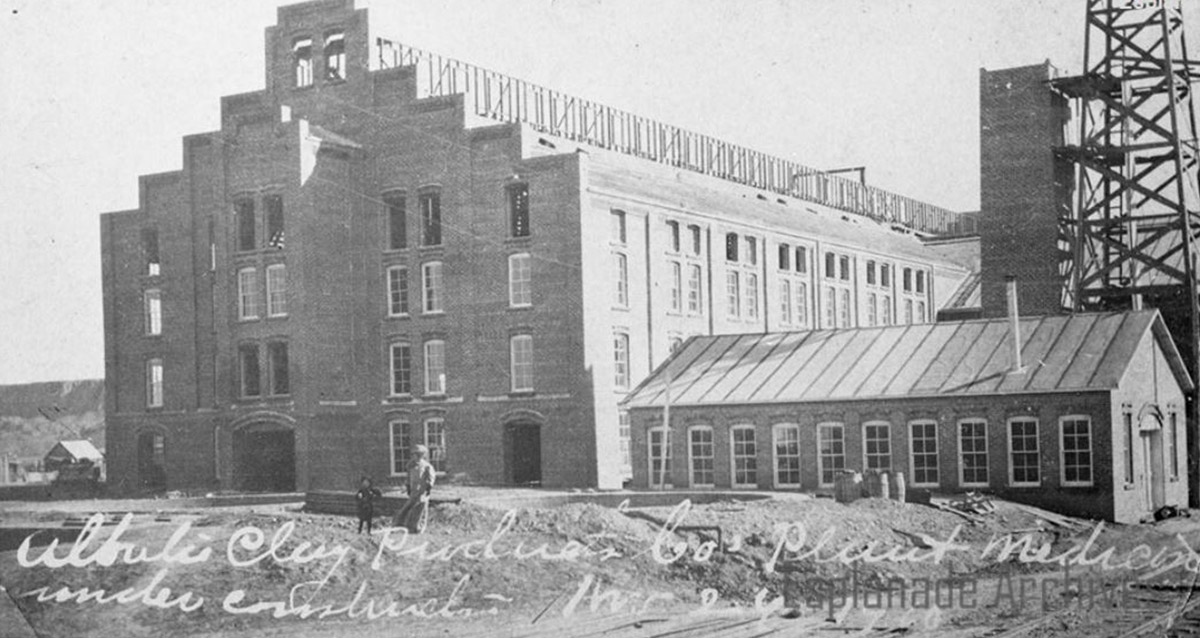
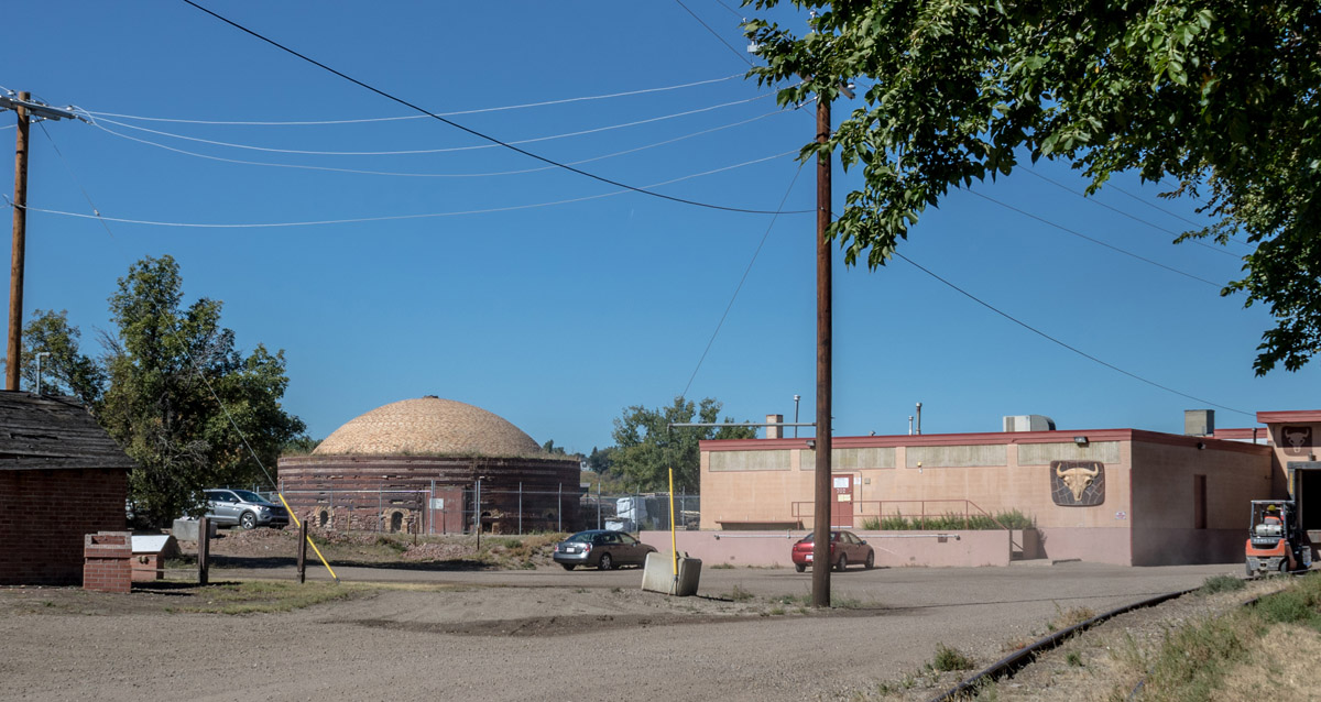
Alberta Clay Products
1910
The building in this photo was the Alberta Clay Products plant, located on Industrial Ave in southern Medicine Hat. The plant opened in 1909, and for many years, clay was a major part of the city's economy. The plant remained in operation, with various operating companies, until 1962, when a fire reduced the building to rubble.
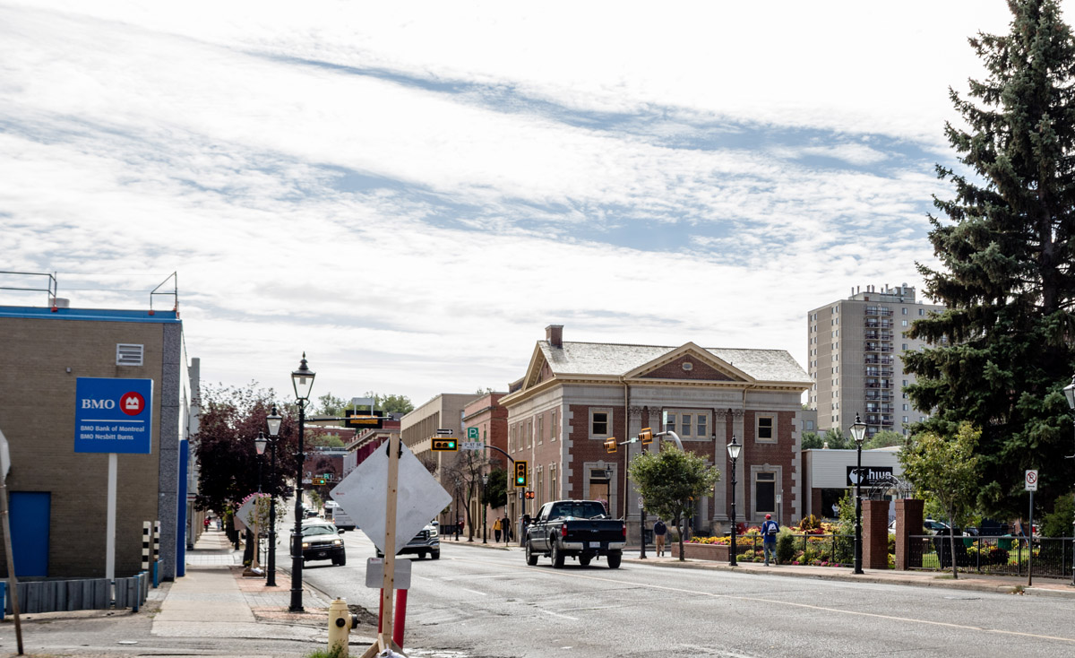
Bank of Commerce
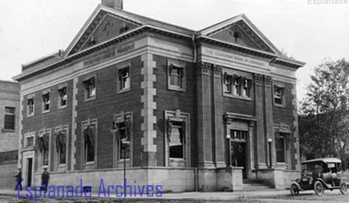
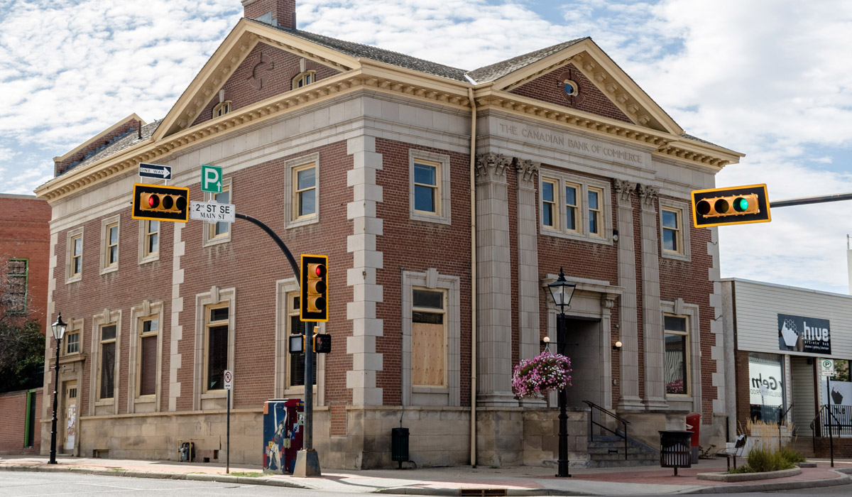
1913
This building, which originally housed the Canadian Bank of Commerce, was constructed in 1908, six years after the Bank of Commerce first opened a branch in Medicine Hat. The impressive brick building is a testament to the rapid economic development of Medicine Hat in the beginning of the twentieth century.
The Public Library
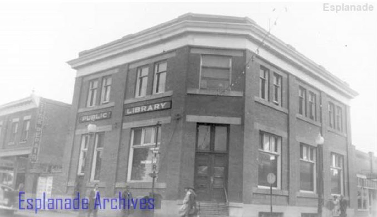
1950
This building was built on Third Street in 1911 as the Bank of Montreal. It became home to the Medicine Hat Public Library in the 1920s, which remained there until 1964.
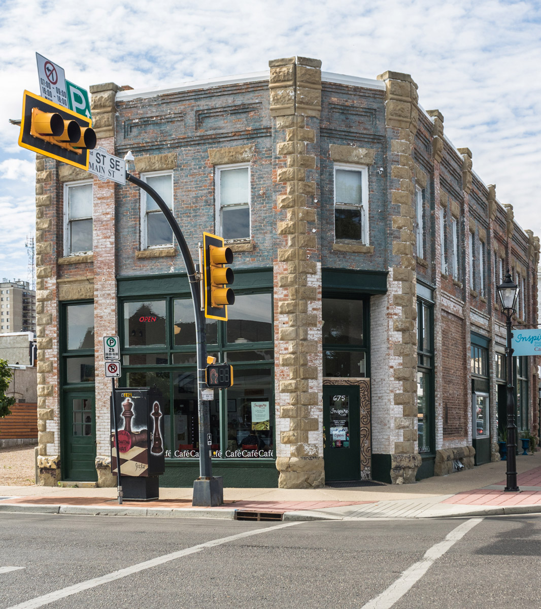
The Beveridge Building
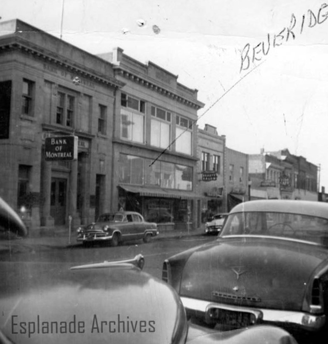
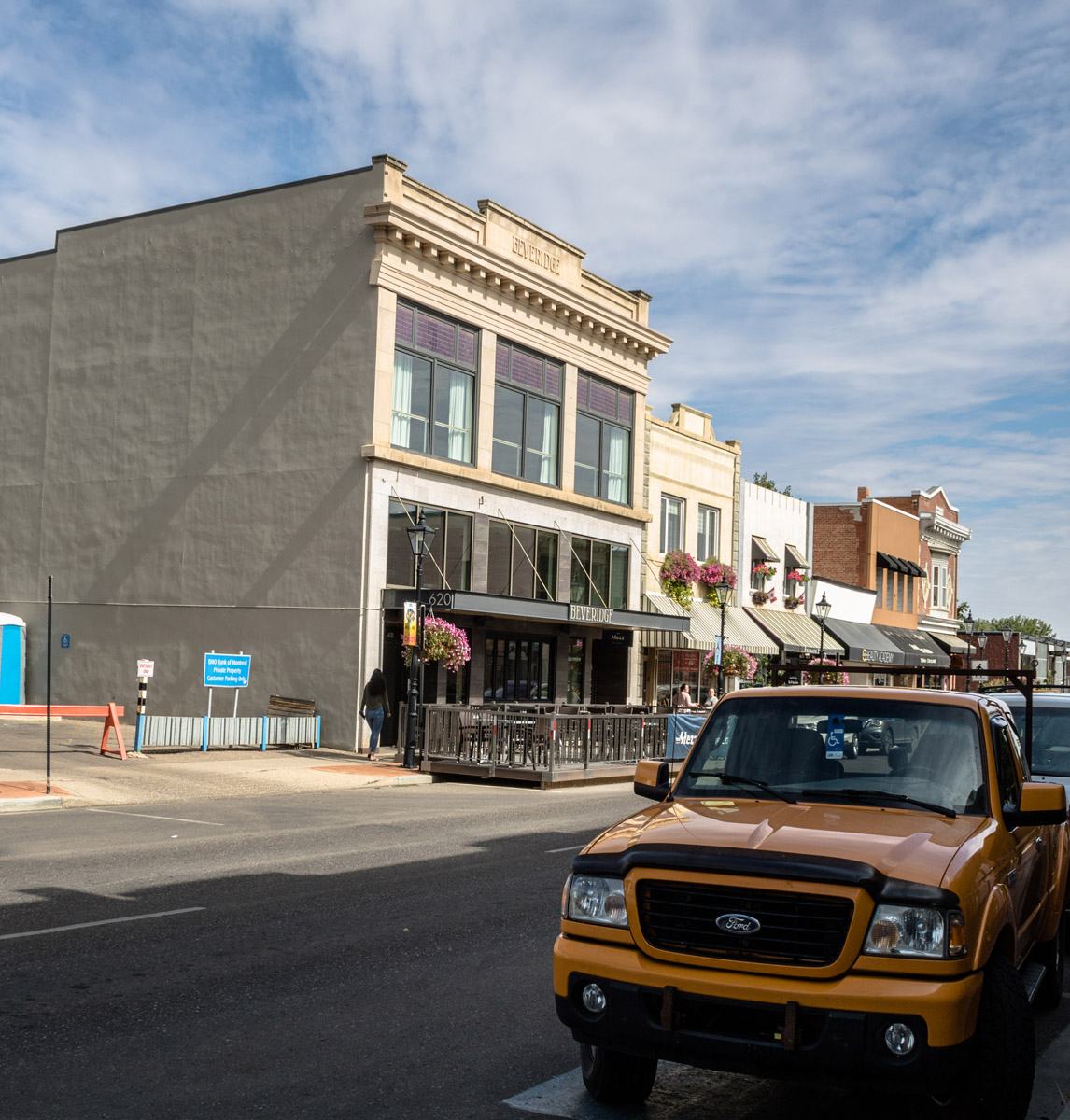
This photograph shows the Beveridge Building on Second Street. This building was constructed in 1911 and named after owner James Beveridge. It originally housed J.C. Beveridge's Ltd Furniture and Men's Furnishing. Today, the building is home to two restaurants and an event hosting company.
Outside Monarch Theatre
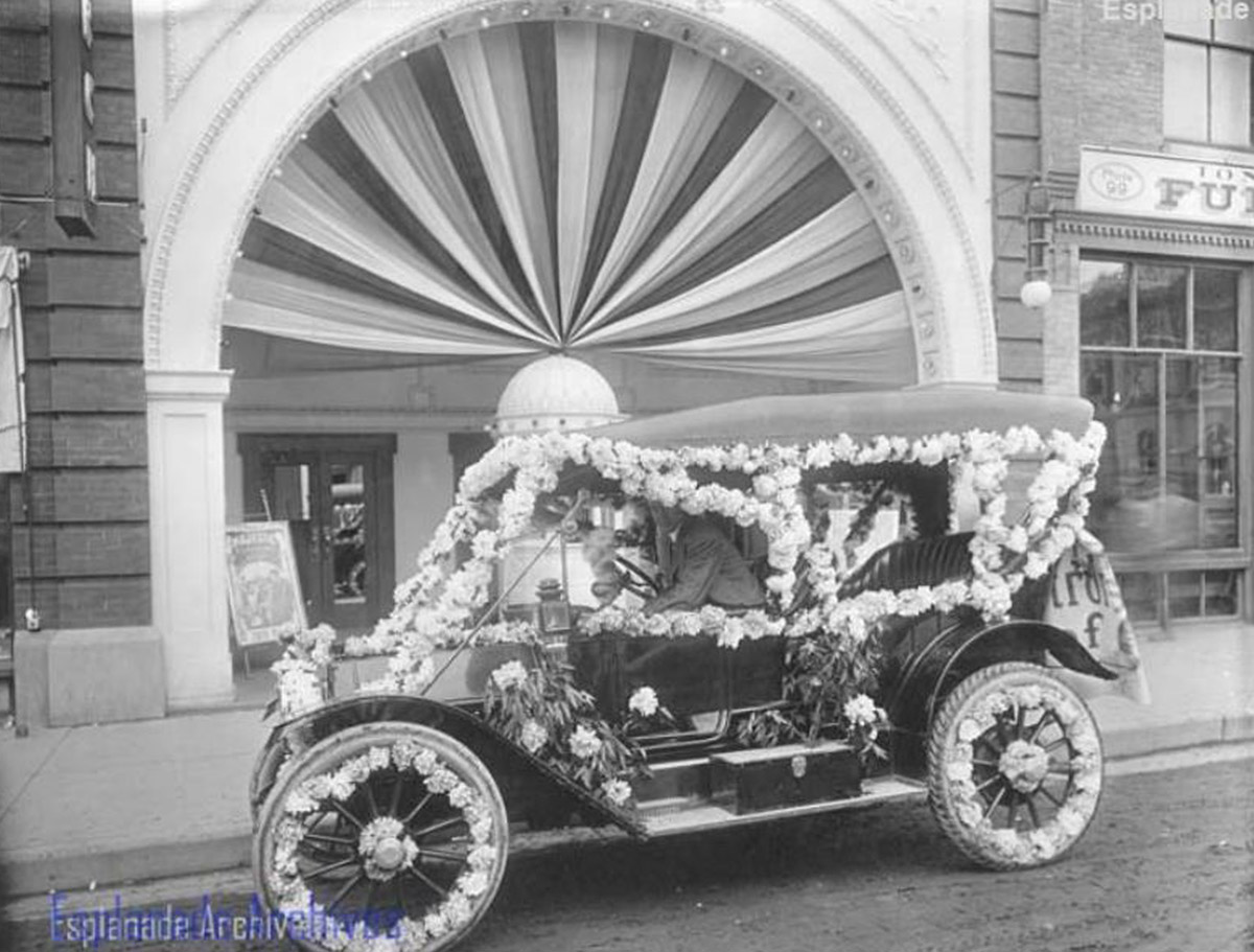
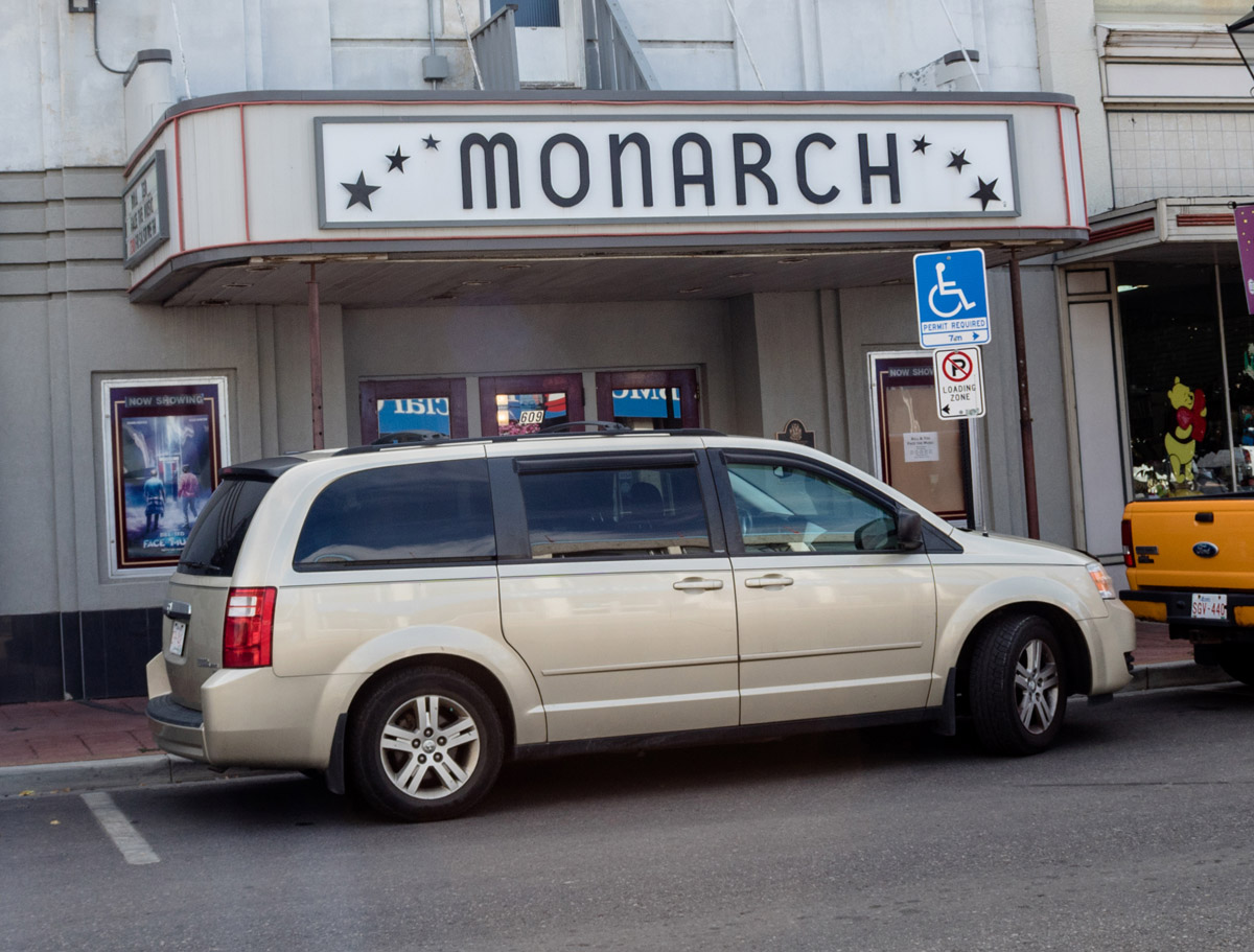
This decorated car is parked outside of the historical Monarch Theatre on Second Street. The theatre was originally built in 1911 as both a motion picture theatre and an amusement house. It included a movie auditorium, pool and billiards rooms, and a tobacco shop.
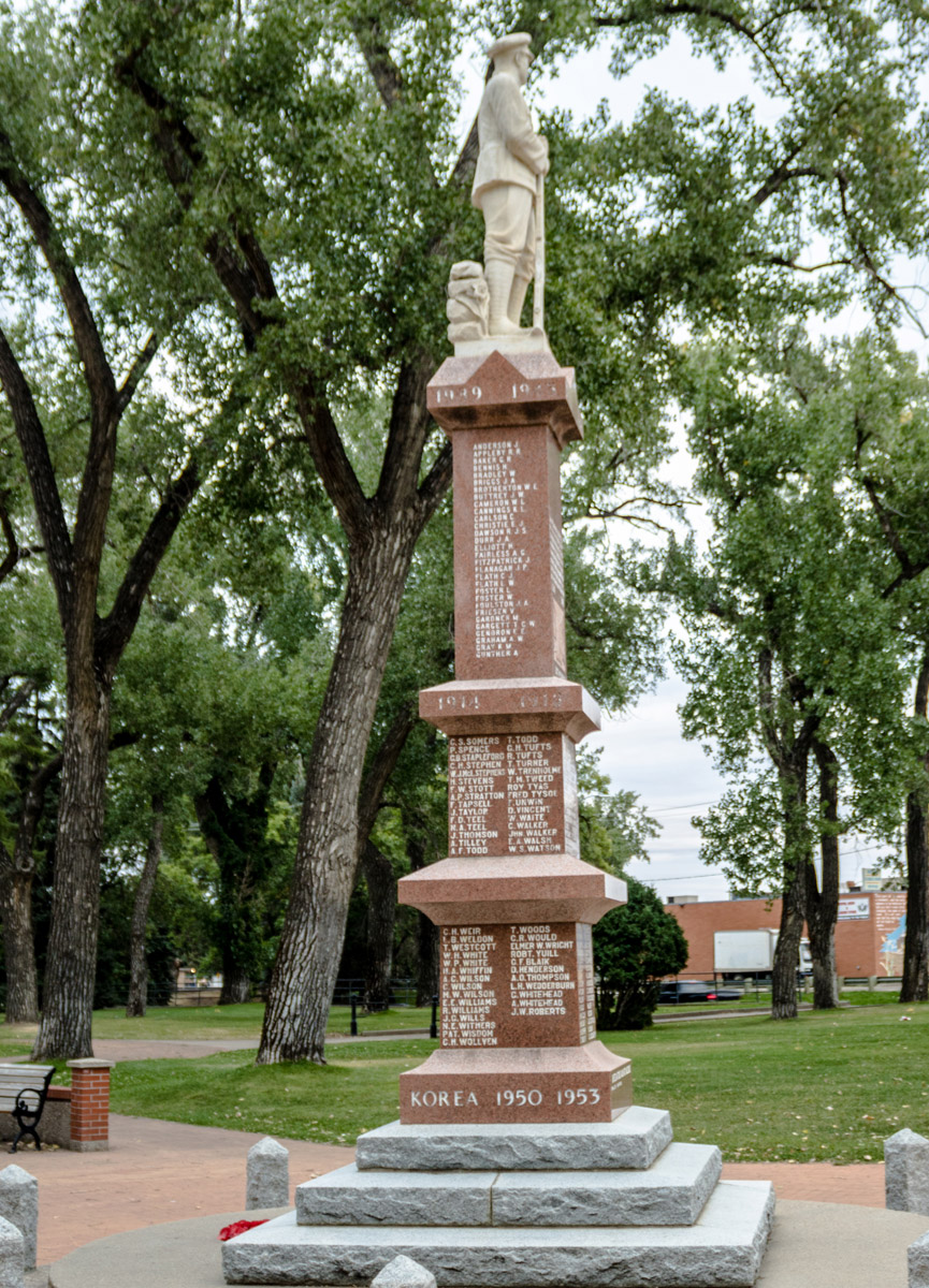
The Cenotaph
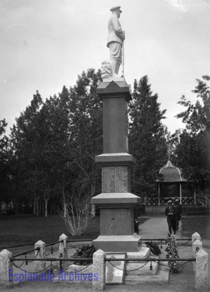
Esplanade Archives 0070.0002.10
This photo shows the Medicine Hat cenotaph located in Riverside Park. The memorial was constructed in 1920 to honour the fallen of the First World War. It was later added to in memory of the fallen of World War II and the Korean War.
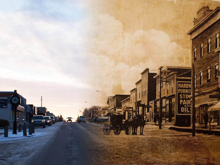
The Drinnan Store
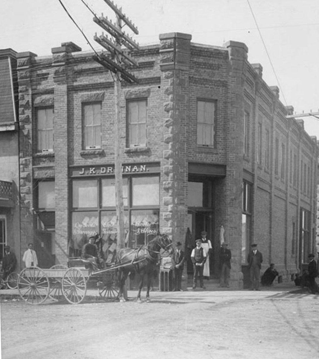
1905
This photograph shows the J.K. Drinnan Store at the corner of South Railway and Second Street. The horse-drawn cart and driver outside the building were likely making a delivery to the store.
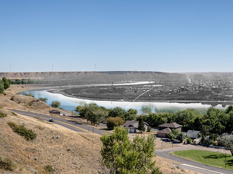
The Finlay Bridge
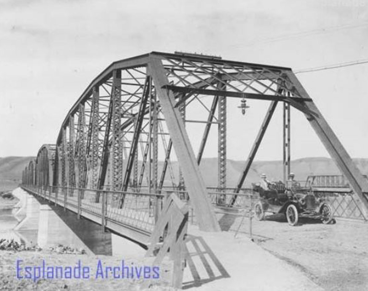
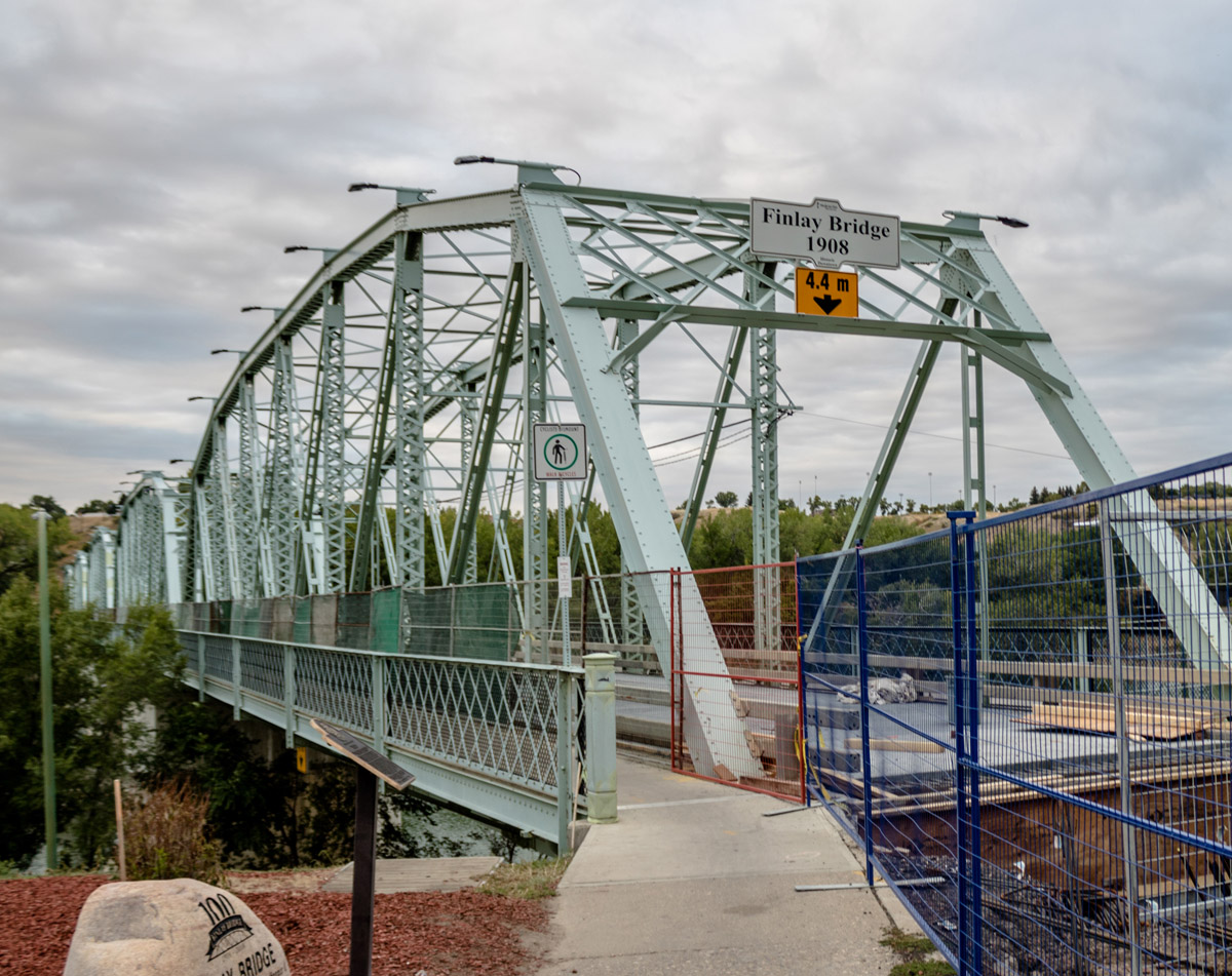
1912
This photograph shows the Finlay Bridge in Medicine Hat, with Curtis Hollinger and Billy Williams driving across in a Ford car. The Finlay Bridge was constructed in 1908 across the South Saskatchewan River and spans 274 metres. Prior to the bridge's completion, travellers had to either take a ferry across the river or cross on the railway bridge.