Partner City
Leeds
The Heart of Yorkshire
Leeds was one of the last great British cities to arrive on the scene. At the writing of the Domesday Book a millennia ago a mere two hundred people were estimated to live on the lands now occupied by the city. In the following centuries growth remained slow, retarded by the logic of medieval settlement whereby towns grew up around castles and readily defensible places and not the other way around. In this respect West Yorkshire was already well served by castles at nearby Pontrefact and Wakefield. Over the succeeding centuries a town did gradually grow in an area roughly bounded by Kirkgate, Briggate and the River Aire. By the time of the English Civil War Leeds was evidently large enough to merit a garrison, and as a Royalist stronghold (the town's motto, Pro Rege et Lege, means 'For King and the law') it was eventually stormed by Parliamentarian forces. All this time the monks at the Kirkstall Monastery just upriver had quietly been drawing income from the cultivation of sheep and their wool. Though the Monks were dispossesed of their abbey during the dissolution of the monasteries, the wool and cloth trade they began around Leeds continued to accelerate in volume and intensity until by the 18th Century Leeds had become a renowned centre for the trade and export of this valuable resource. The town was therefore well placed to take advantage of the new technologies revolutionizing the textiles industry, the breahtaking Cloth Hall a symbol of the wealth accumulated by this burgeoning industry. The construction of a network of canals, and later railways, knitted the Midlands together and caused the population of to explode. The city's industry contributed massively to ultimate victory in both World Wars. But the tragedy of the Great War was felt in every home when Pals' Battalions raised in Leeds were scythed down by machine guns on the Somme. As the 20th Century wore on Leeds could not avoid the deindustrialization that affected most British cities, but active and energetic leadership from government and private enterprise have allowed the city to make the difficult transition to a service economy from a manufacturing-based one. Today Leeds is one of the economic engines of the British Isles with a growing population and rising international profile. For the purposes of this essay it is worth noting that large tracts of the city were radically redesigned during the Inter-War period. Streets were widened, slums cleared, alleys abolished. This made finding some spots quite difficult and some of these photos represent my best guesses at where the original was taken. The Then Photos are reproduced courtesy of, Leodis, Leeds' Online Photographic Archive. I took the Now photos in March 2015.


Explore
Leeds
Then and Now Photos
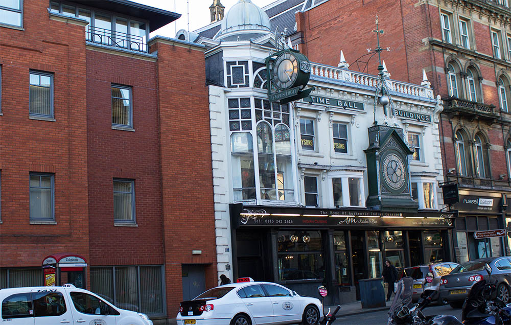
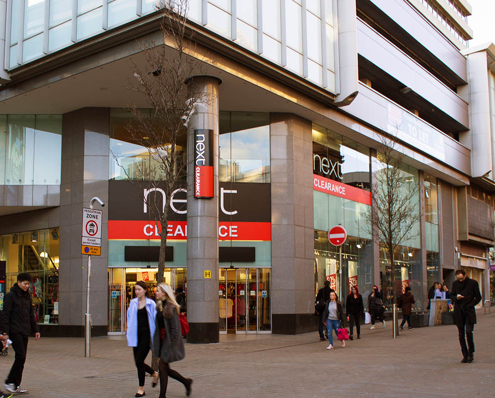
Kirkgate Market
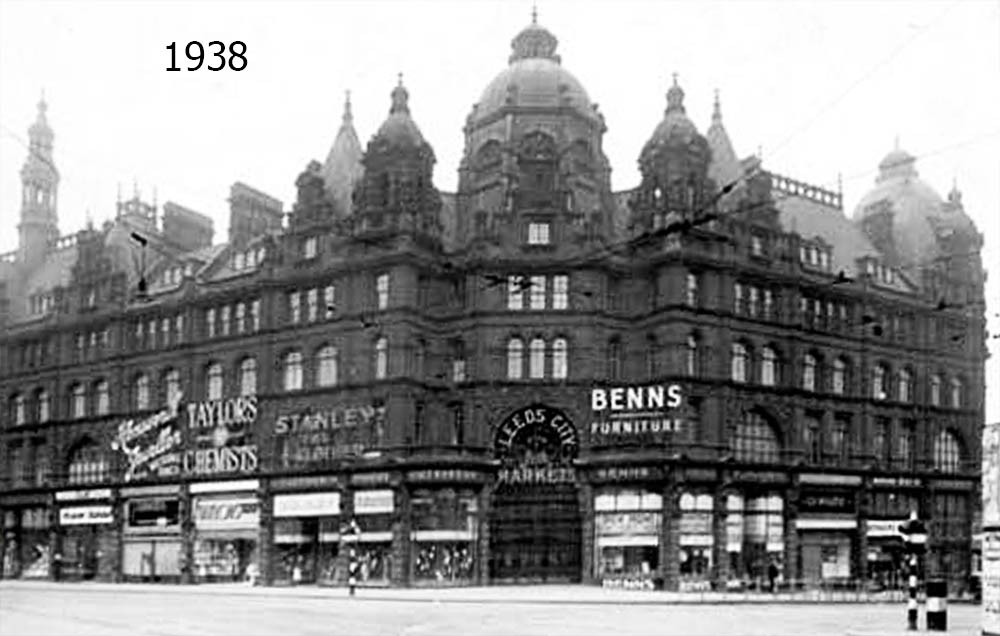
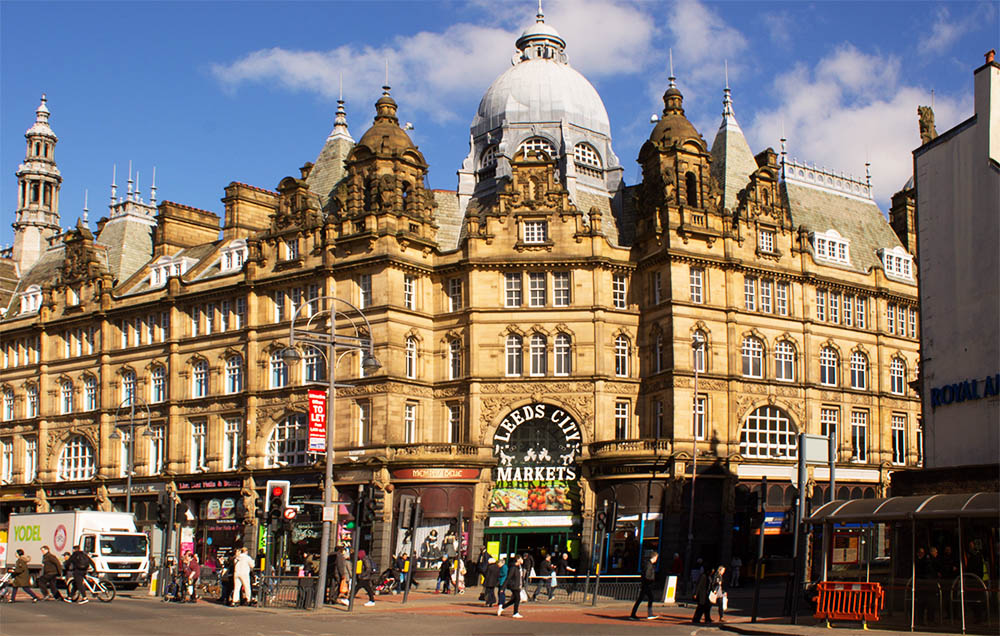
Leodis Online Photo Archive ID 200266_8596438.
1938
Kirkgate Market is so quiet here this photo must have been taken first thing in the morning.
Laying Tracks on Briggate
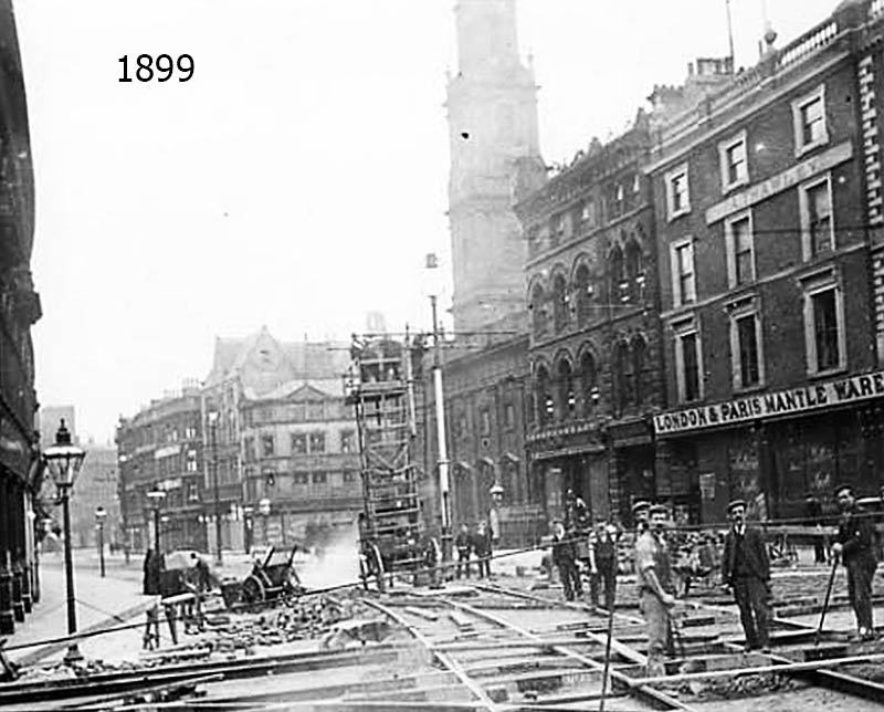
Leodis Online Photo Archive ID 2003103_36210269.
1899
Workmen take a break from laying tram tracks at the intersection of Briggate and Boar Lane to pose for a photograph. This is one of the few places in Leeds where most of the buildings have remained the same.
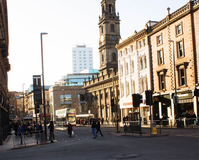
Homes on Briggate
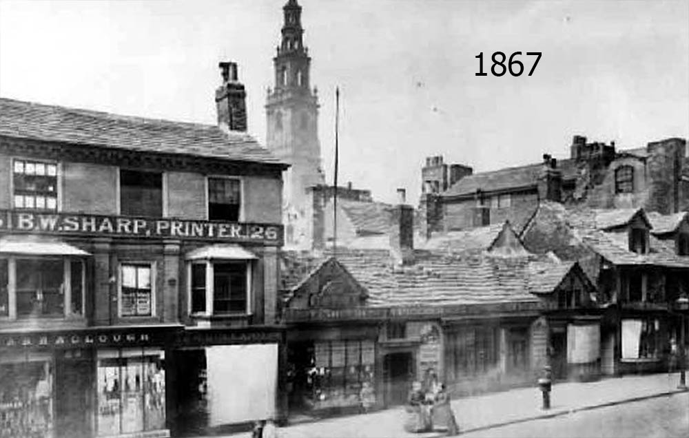
Leodis Online Photo Archive ID 8449.
1867
One of the oldest pictures I came across of Leeds was this one taken of Tudor-era cottages on Briggate. Very few of this style of home have survived the centuries. You can see in the top of my photo the spire of Holy Trinity Church on Boar Lane, confirming this as the correct location.
People in the Window
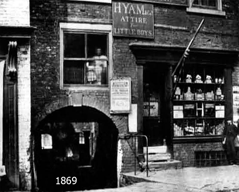
Leodis Online Photo Archive ID 8283.
1869
In this rather spooky photo, two ghost-like figures, one an adult and one a child, appear in the window above a barber shop on Bridgeend, just across the Aire from Briggate. The building on the left survives as the Old Red Lion pub. Though I'm not entirely sure I got the window exactly right, this is definitely the correct building.
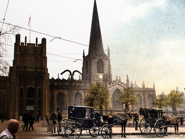
Holy Trinity Church
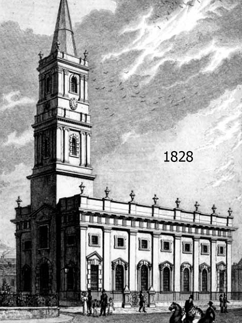
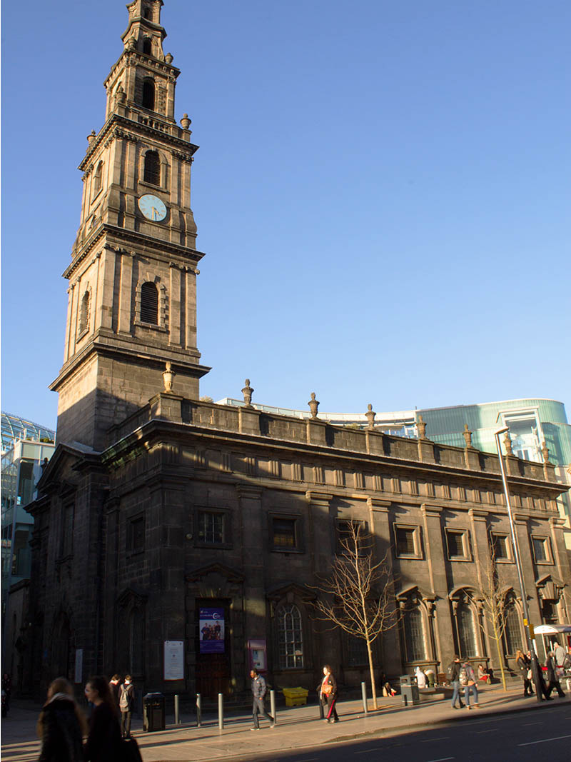
Leodis Online Photo Archive ID 9107.
1828
A sketch of Holy Trinity Church on Boar Lane. Designed by William Etty, this neo-Classical church was completed in 1727, though it would be another century before the current steeple was added after the original (seen in the old photo) was blown down in a storm.
Market Day
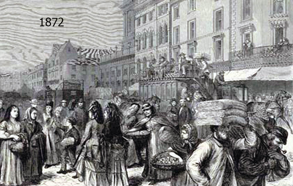
Leodis Online Photo Archive ID 20021128_65343875.
1872
The streets at the heart of Leeds are filled on a busy market day in the 19th Century.
Queen's Arcade
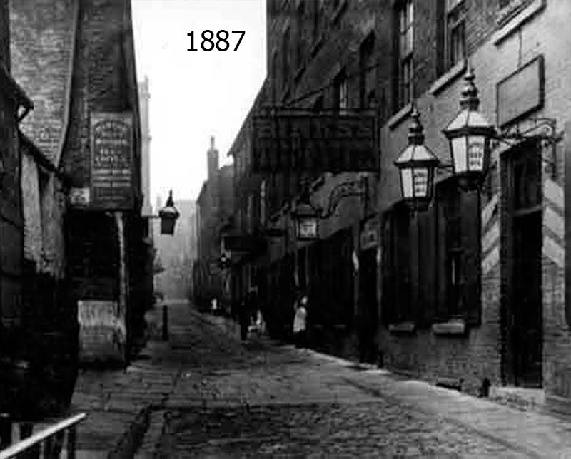
Leodis Online Photo Archive ID 8436.
1887
Before the Queen's Arcade was a swanky stretch of covered shops it was a rather narrow alley filled with pool halls, hotels and pubs.
Land's Lane
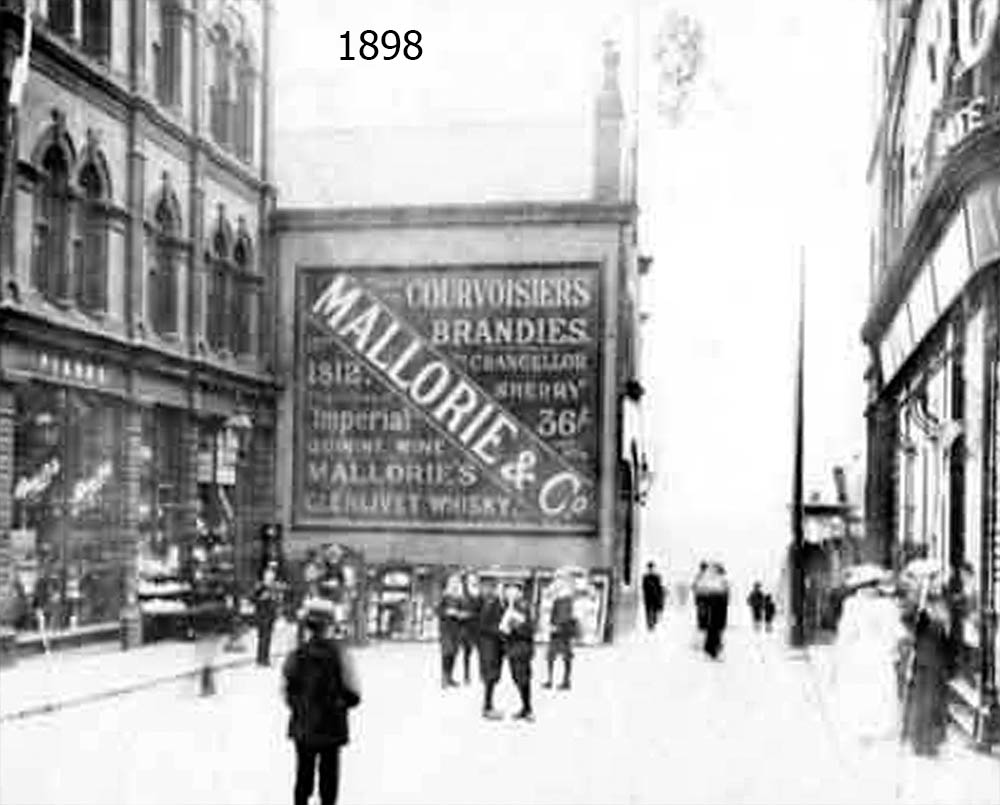
Leodis Online Photo Archive ID 8310.
1898
A busy street scene on Land's Lane. Scaffolding has been erected in front of the Victoria Arcade.
Albion Street
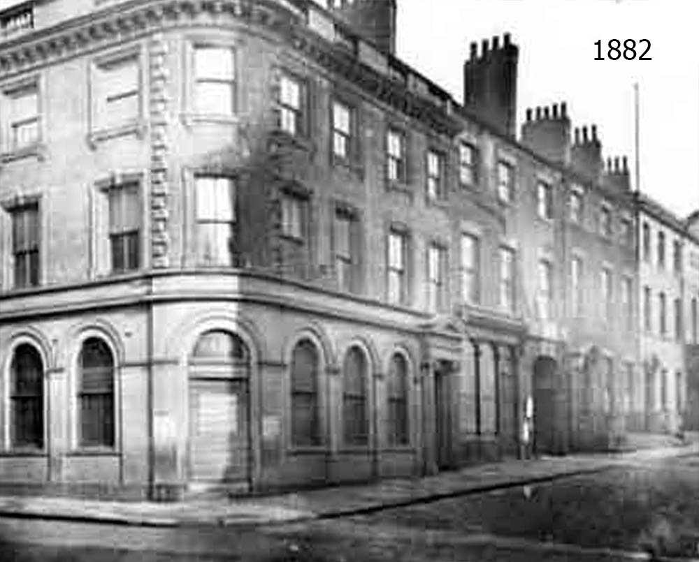
Leodis Online Photo Archive ID 7952.
1882
21st Century Albion Street bears little resemblance to 19th Century Albion Street. This is at the intersection with Bond Street.
Yorkshire Bank
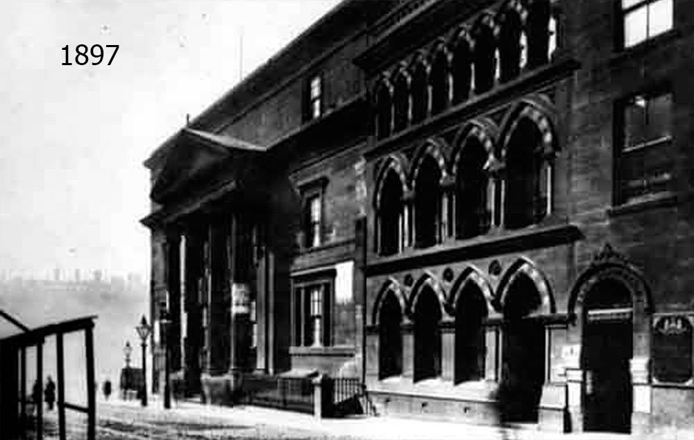
Leodis Online Photo Archive ID 8635.
1897
The bottom of Park Row. Here we see the old post office as well as the chambers for Yorkshire Bank.
City Square
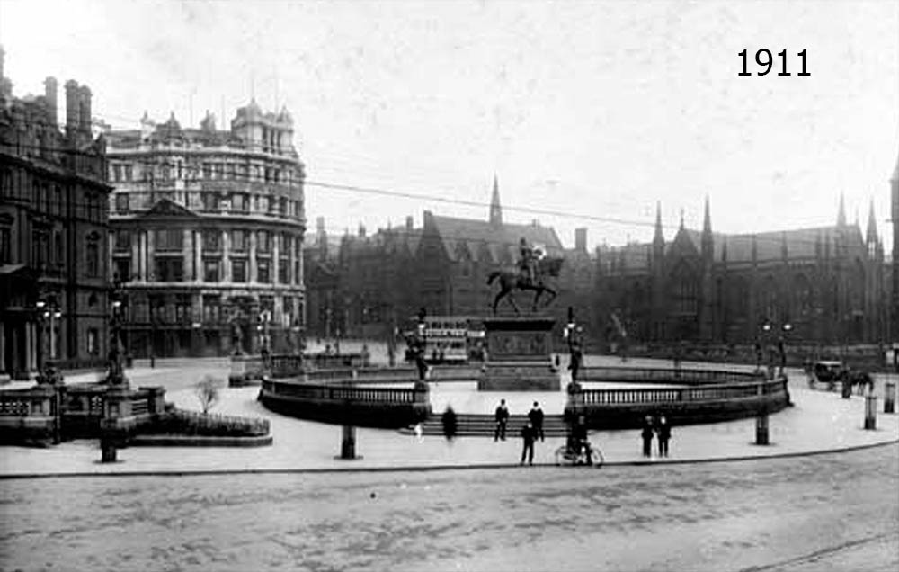
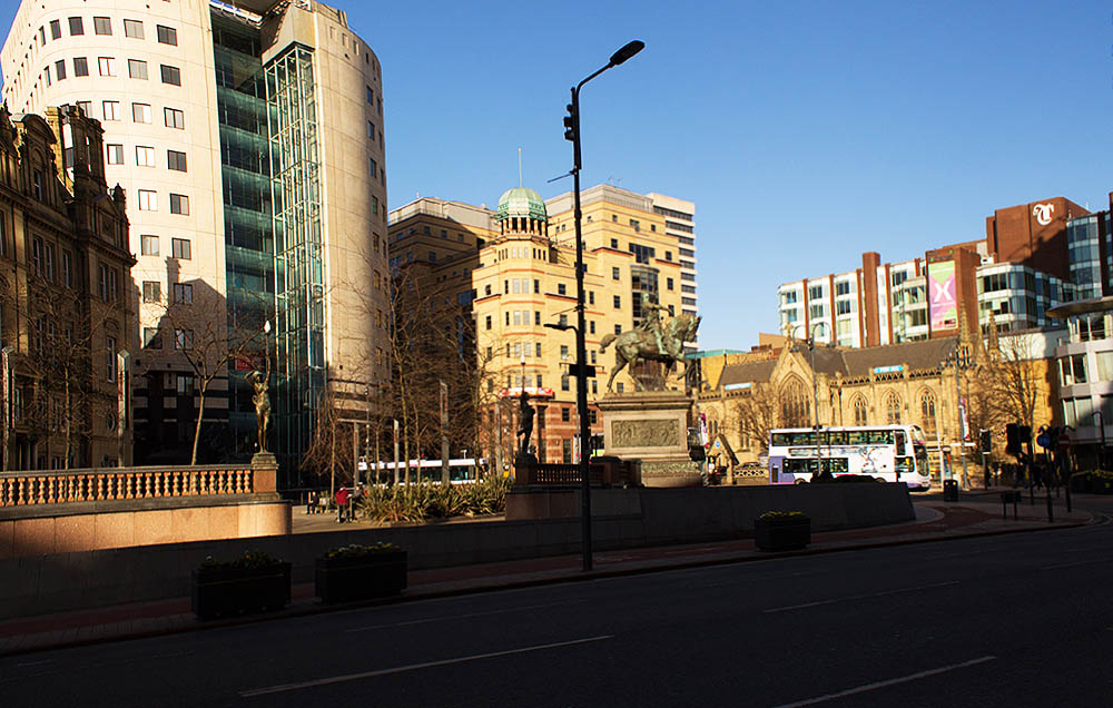
Leodis Online Photo Archive ID 515.
1911
The statue of the Black Prince figures prominently in this photo of City Square. On the left is the newer old post office, while on the right is Mill Hill Chapel. It looks like much of the square has been remodeled as well.
Yorkshire Banking Company
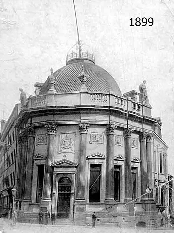
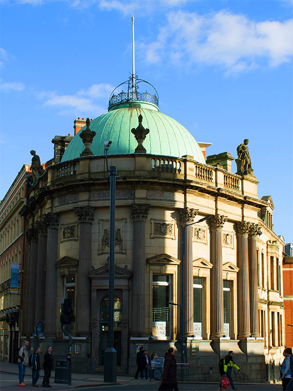
Leodis Online Photo Archive ID 2003102_13103884.
1899
Several people loiter in front of the headquarters of the Yorkshire Banking Company. This photo was taken just after the building's completion. Above the door is the coat of arms of the city of Leeds, owls and all.
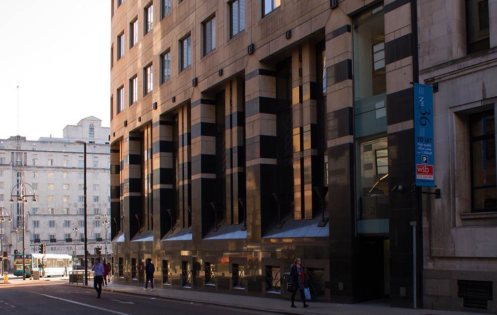
St. Paul's Church
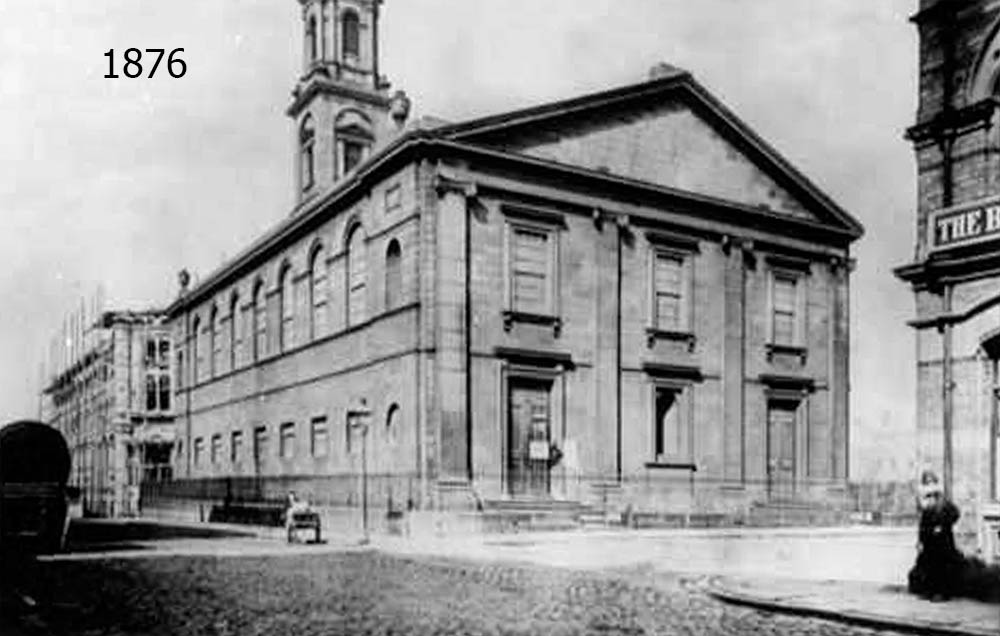
Leodis Online Photo Archive ID 9075.
1876
We see here Saint Paul's Church, which lends its name to the street on which it once stood. It was demolished in 1905 to make way for the offices of the city's water board.
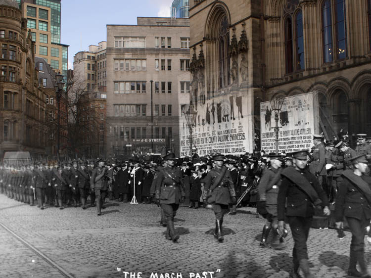
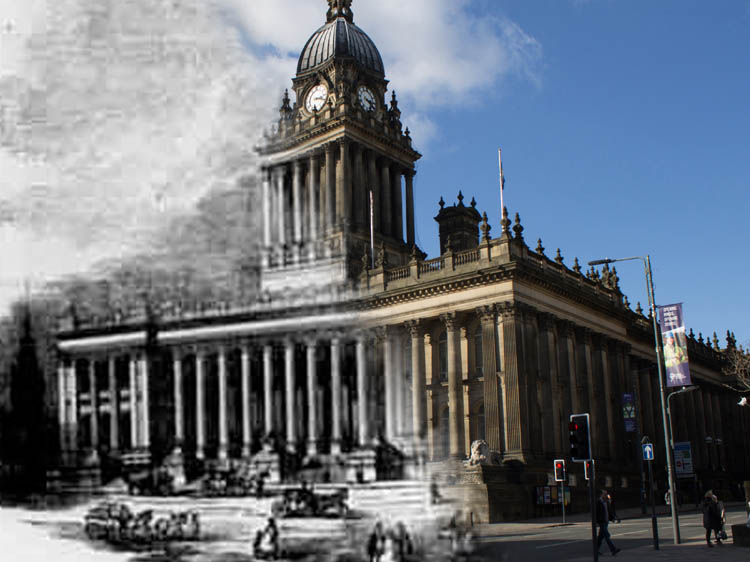
Town Hall
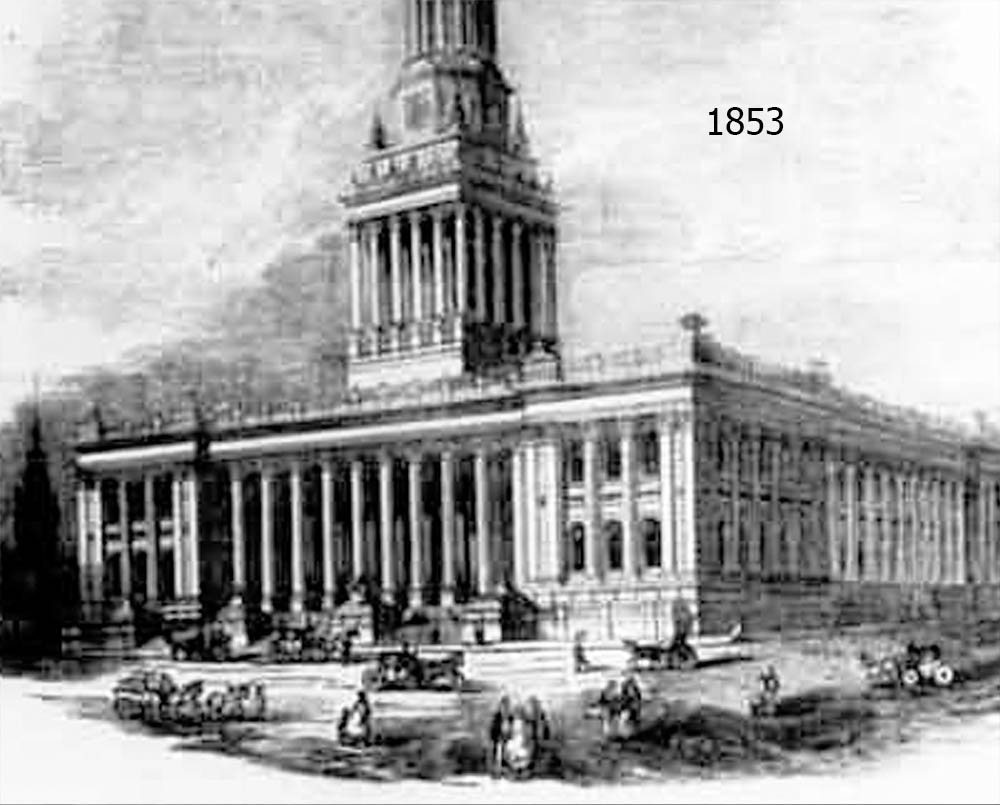
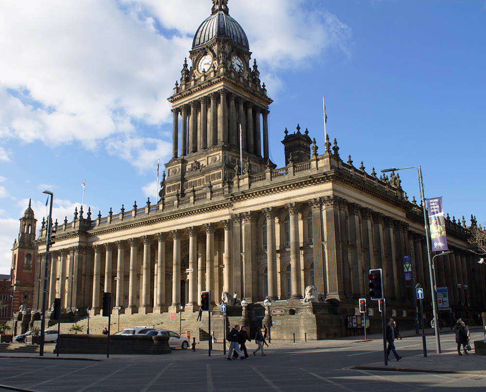
Leodis Online Photo Archive ID 8819.
1853
A rather low-resolution engraving of the impressive Town Hall near the end of its construction.
Celebration in Town Hall
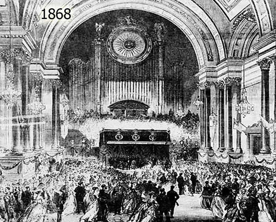
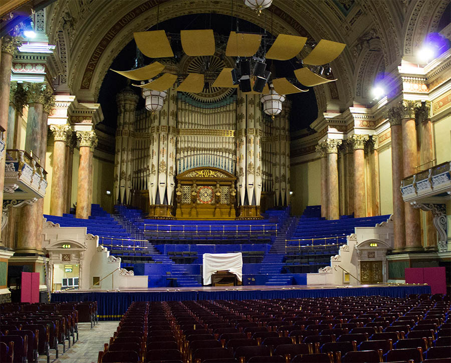
Leodis Online Photo Archive ID 2003121_86756534.
1868
A ball at the Town Hall to celebrate the Prince of Wales's visit to Leeds. The first dance with the prince was reportedly had by Mrs. Fairbairn, the mayor's wife, who along with her husband were hosting the ball.
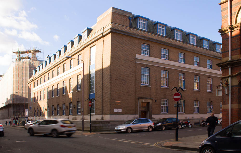
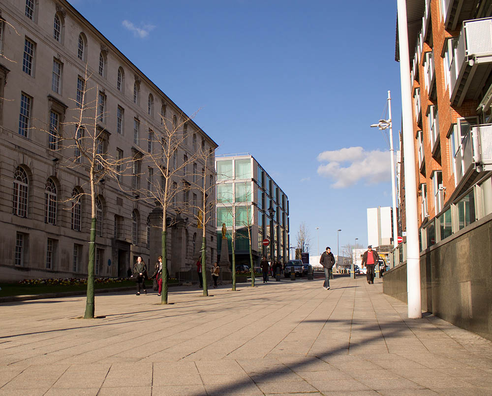
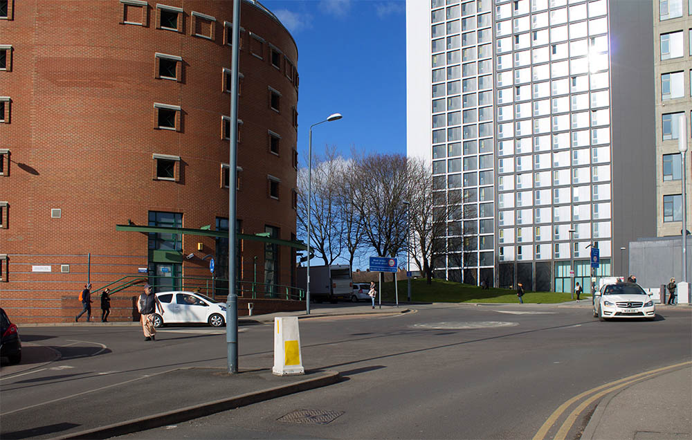
Children on Portland Crescent
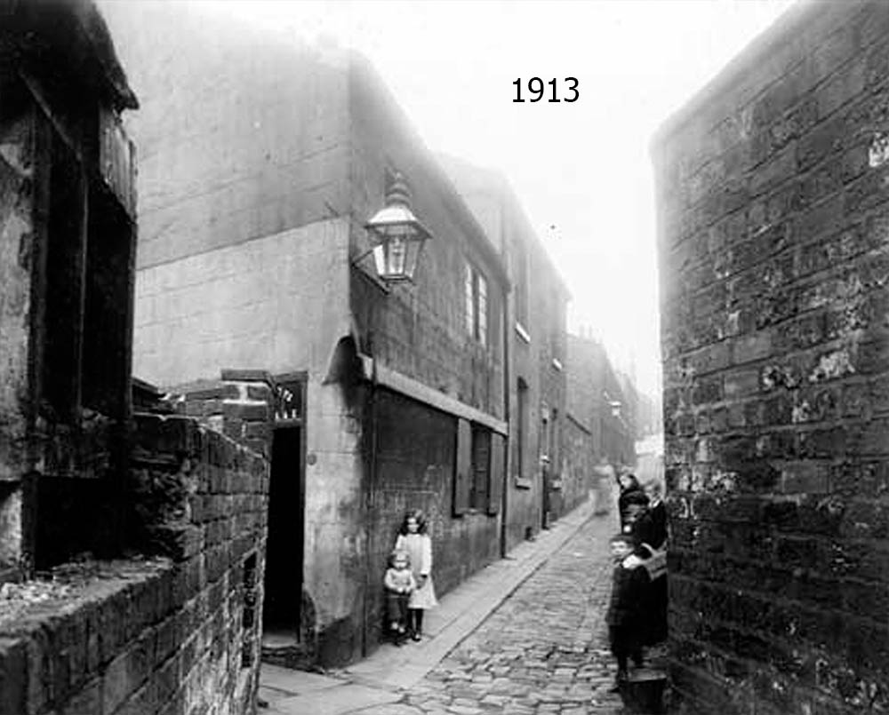
Leodis Online Photo Archive ID 9810.
1913
The imposing Civic Hall on Portland Crescent was once a warren of slums. So in the depths of the depression, the scheme to build the Civic Hall was intended to clear out the slums while providing badly needed jobs for the unemployed.
Construction on Fenton St.
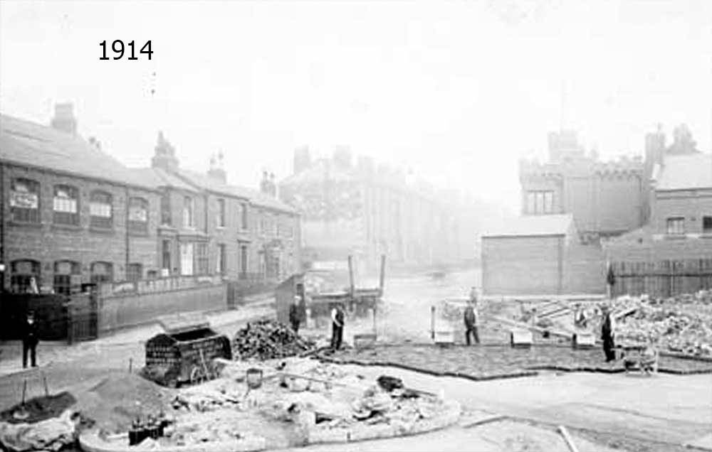
Leodis Online Photo Archive ID 2002131_57375735.
1914
This is the probable location for an extension to Fenton Street that occurred in 1914 only days after the start of the First World War. Later on the construction of the A58 completely reshaped the entire area, rendering it barely recognizable.
Stores on Headrow
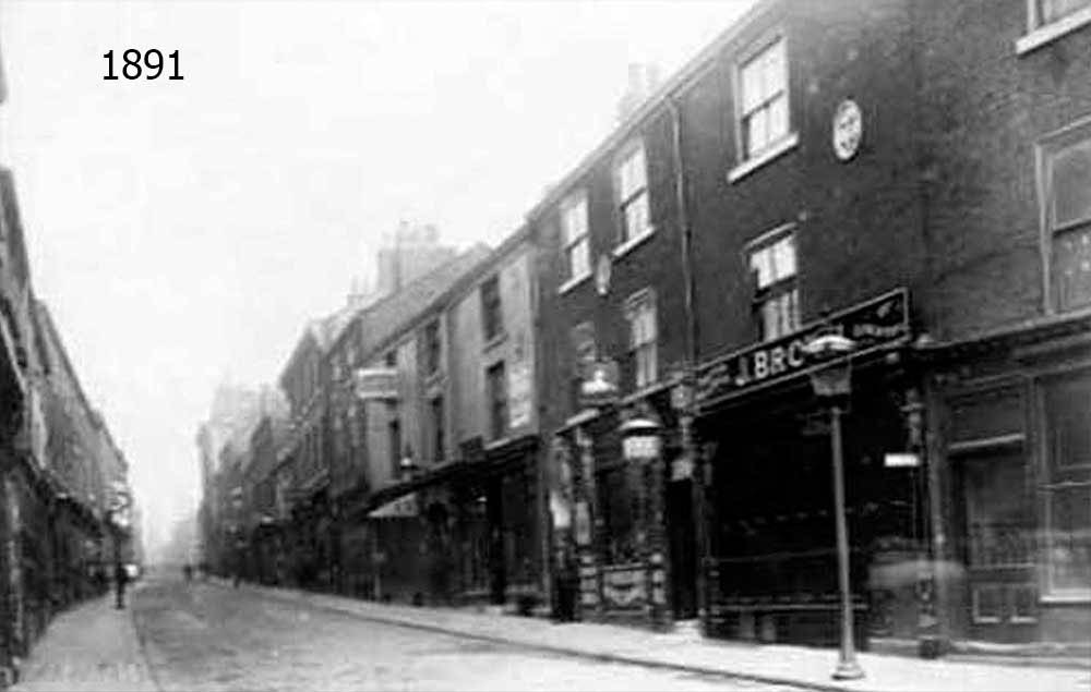
Leodis Online Photo Archive ID 20031118_88625735.
1891
This early shot of Headrow was taken before the street was widened and redesigned at the end of the 1920s. Before it was a major thoroughfare across the city it was a rather minor street.
People on Nelson Street
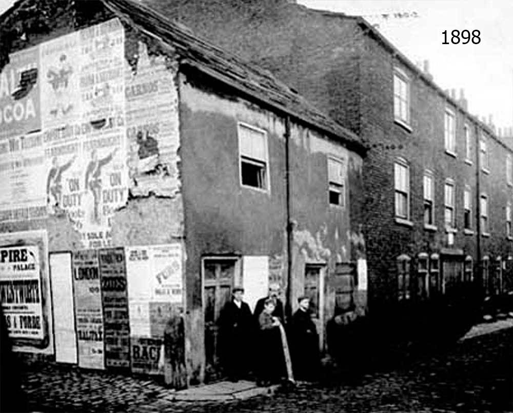
Leodis Online Photo Archive ID 2002319_65848941.
1898
Some people pose for a photo at the end of Nelson Street. Nelson Street no longer exists, swept away in the dramatic redesign of the city centre during and after the First World War. But it did run parallel to Union Street. This was my best guess at where it may have once lain.
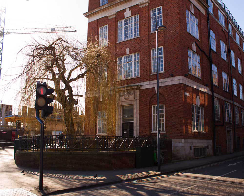
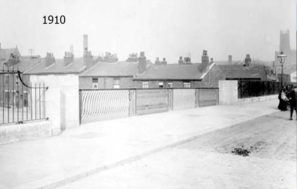
Brige over Bridge Street
Leodis Online Photo Archive ID 200294_82580203.
1910
A view of the bridge over Bridge Street. The residential neighbourhoods in the background have become parking lots and office blocks.
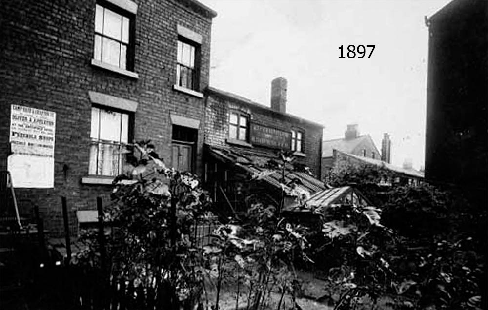
A Backyard
Leodis Online Photo Archive ID 1253.
1897
Looking over someone's garden on Grafton Street.
Kirkstall Abbey From Afar
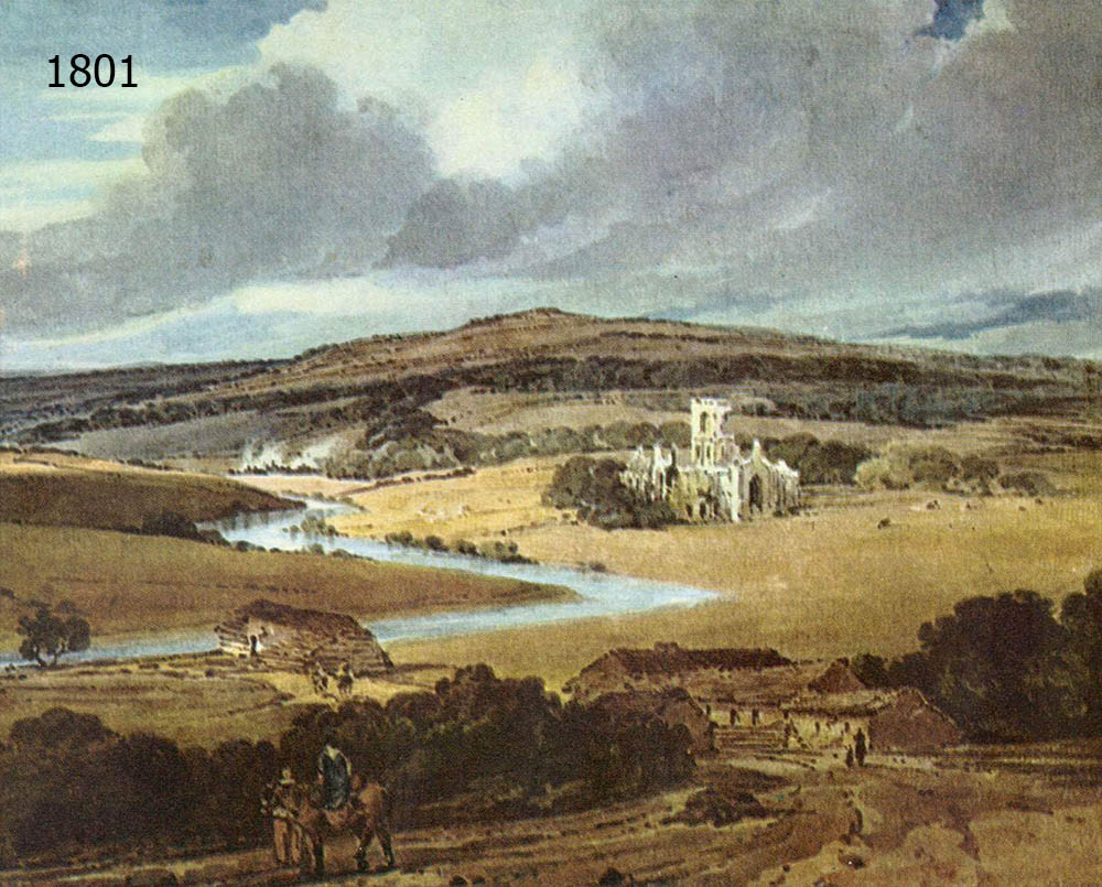
British Museum Online Collection
1801
Kirkstall Abbey, by Thomas Girtin. The picturesque ruins of Kirkstall Abbey were a magnet for Romantic painters, who were fascinated by the tranquil scenery that surrounded the towering ruins.
Ruins of Kirkstall Abbey
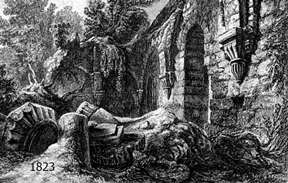
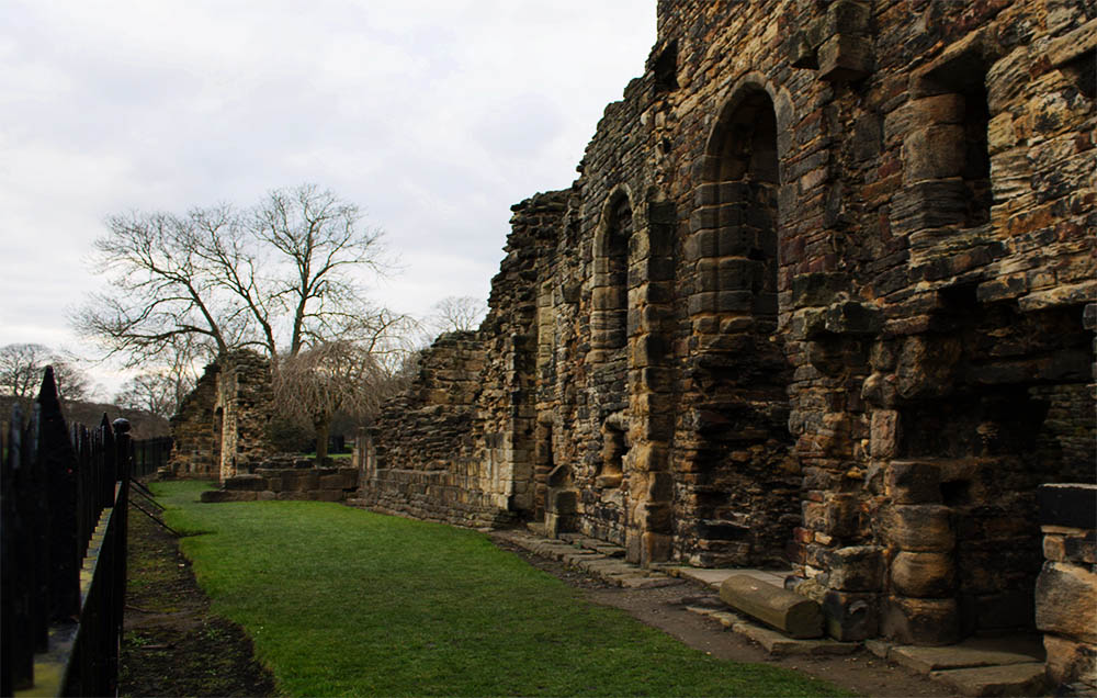
Leodis Online Photo Archive ID 20031118_88625735.
1823
Another Romantic style engraving of the ruins of Kirkstall Abbey's refectory (dining room) by George Cuitt. The Abbey itself was founded in 1152 on the banks of the River Aire. Four hundred years later the abbey was dissolved on order of King Henry VIII and the buildings fell into ruin.
Painting of Kirkstall Lock
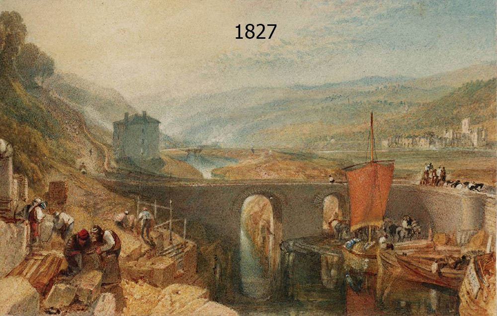
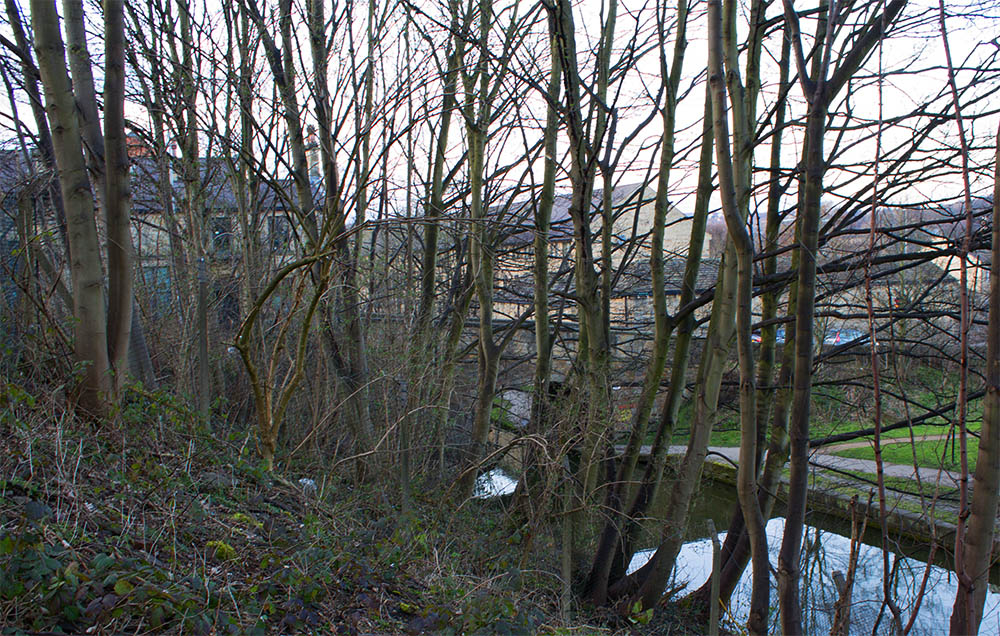
1827
"Kirkstall lock on the River Aire" by J.M. Turner. He was painting from a hill overlooking one of the smaller branches of the Aire. The Bridge in the foreground still stands, and if you look carefully you can just make out the abbey's ruins between the tree branches of my photo. The hill where he sat to paint is now overgrown with trees and strewn with litter.